|
|
MARIA MAGDALENA - SANTO GRIAL: MUJER DE MOISES ERA CUSITA (ETIOPIA)/SERPIENTE/RIO NILO/SABADO/SABIDURIA
Choose another message board |
|
Reply |
Message 1 of 39 on the subject |
|
|
LA MUJER DE MOISES ERA CUSITA (ETIOPIA)- EL MISMO MOISES ERA EGIPCIO.
findmyheritage.wordpress.com/.../¿-por-que-tomo-moises-a-sefora-por-e...
5/10/2010 - "Y aquel varón dio su hija Séfora por mujer a Moisés" (Exodo 2:21). ... Miriam y Aarón hablaron contra Moisés por causa de la mujer cusita con ...
www.claiweb.org/ribla/.../una%20relectura%20de%20numeros%2012.ht...
¿Qué tiene que ver la cusita con el liderazgo que le está siendo cuestionado a Moisés? Y ¿qué si la cusita y Séfora son la misma mujer? Partiendo de nuestra ...
27/4/2009 - El término “cusita” puede referirse a los habitantes de la tierra de Cus ... Después que huyó de Egipto, Moisés se casó con Séfora, hija de Jetro ...
denepaz.es.tl/Esposa-de--Moises--cusita.htm
Biblia: Si "María y Aarón hablaron contra Moisés a causa de la mujer cusita que había tomado, porque él ... En realidad el padre de Séfora era madianita (Exo.
elcaminante.blog.com.es/.../moises-tuvo-una-segunda-esposa-12234446/
29/11/2011 - Todos sabemos que Moisés tuvo una esposa llamada Séfora hija del ... y Aarón hablaron contra Moisés a causa de la mujer cusita que había ...
www.wikicristiano.org/diccionario-biblico/4040/séfora/
Información acerca de el significado de la palabra Séfora. Definiciones ... En Nm. 12:1 y 2 a la esposa de Moisés se le da el calificativo de mujer "cusita".
www.slideshare.net/chucho1943/05-moises-y-sefora
3/9/2007 - Mois és y Séfora: Relaciones con parientes ” ... Números 12:1-3 menciona a la esposa de Moisés como Cusita, algunos sugieren que es otra ...
www.comunidadbetor.org/la_mujer_kushita.html
Núm 12:1 María y Aarón hablaron contra Moisés a causa de la mujer cusita que ... La Torá nos narra que la esposa de Moshé se llamaba Séfora o Tzifora, y era ...
[PDF]
www.pmministries.com/CEES/2007/ES3/PowerPoint/MP5.pdf
4/8/2007 - El primer hijo que tuvieron Moisés y Séfora significa: "destierro", de .... “Aunque se la llama "mujer cusita" (V.M.) o "etíope," la esposa de Moisés.
... Answers > Categorías > Religión y espiritualidad > Cristianismo > Catolicismo > La Biblia. > ¿Moisés tomó otra esposa además de Séfora una mujer cusita?
|
|
|
|
|
Reply |
Message 25 of 39 on the subject |
|
PARA NO CREER PERO ESTO ES ASI. LA RELACION DEL DINERO / MONEY / MOON / CON LA LUNA EN EL CONTEXTO A LA TRANSFIGURACION EN EL MONTE HERMON / MON / LUNA EN LA TRIBU DE DAN / DINERO / SERPIENTE. TODO ES UN NEXO CON LA TRANSFIGURACION DEL SEÑOR. DINERO ES TIEMPO MISMO.
ES OBVIO EL NEXO DE LA SERPIENTE CON LA MUJER
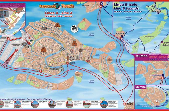
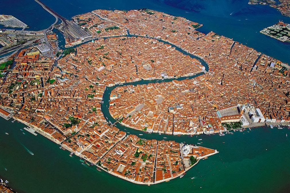
NOTEN EL NEXO DE DAN, CON LA SERPIENTE (VENECIA) Y EL CABALLO (PLAZA SAN MARCOS)
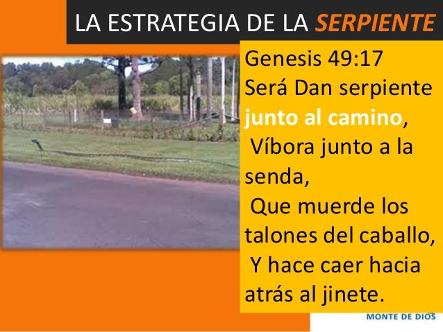
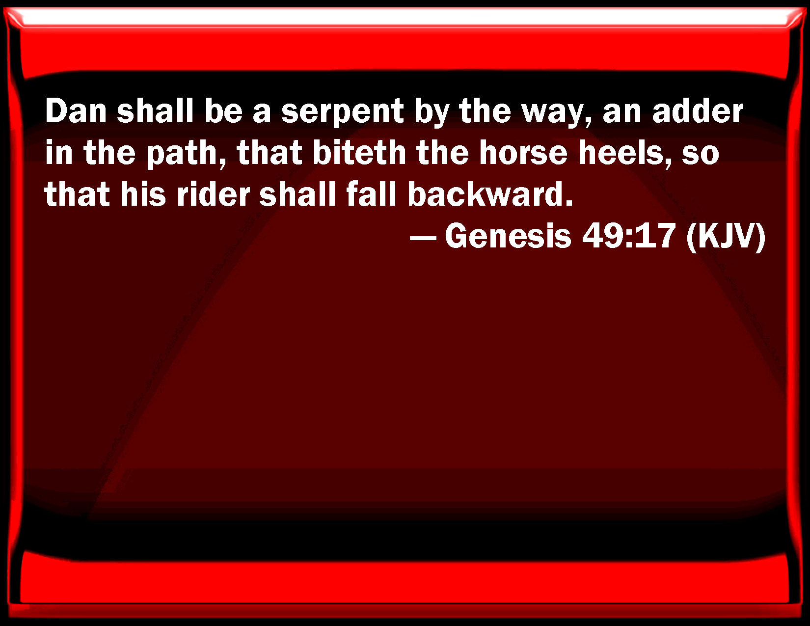
7. Génesis 49:17 Será Dan SERPIENTE junto al camino, Víbora junto a la senda, Que muerde los talones del caballo, Y hace caer hacia atrás al jinete.
|
|
|
|
Reply |
Message 26 of 39 on the subject |
|
|
|
|
Reply |
Message 27 of 39 on the subject |
|
|
|
|
Reply |
Message 28 of 39 on the subject |
|
|
|
|
Reply |
Message 29 of 39 on the subject |
|
|
|
|
Reply |
Message 30 of 39 on the subject |
|
|
|
|
Reply |
Message 31 of 39 on the subject |
|
|
|
|
Reply |
Message 32 of 39 on the subject |
|
|
|
|
Reply |
Message 33 of 39 on the subject |
|
TAG: NILE FLOODING SIRIUS
 Looking east from latitude 30 north on August 3rd, 30 minutes before sunrise. (Created by the author in Stellarium).
Can you feel the heat?
It’s not just your imagination. The northern hemisphere is currently in the midst of the Dog Days of Summer. For many, early August means hot, humid days and stagnant, sultry nights.
The actual dates for the Dog Days of Summer vary depending on the source, but are usually quoted as running from mid-July to mid-August. The Old Farmer’s Almanac lists the Dog Days as running from July 3rd through August 11th.
But there is an ancient astronomical observation that ties in with the Dog Days of Summer, one that you can replicate on these early August mornings.
The sky was important to the ancients. It told them when seasons were approaching, when to plant crops, and when to harvest. Ancient cultures were keen observers of the cycles in the sky. Cultures that were “astronomically literate” had a distinct edge over those who seldom bothered to note the goings on overhead.
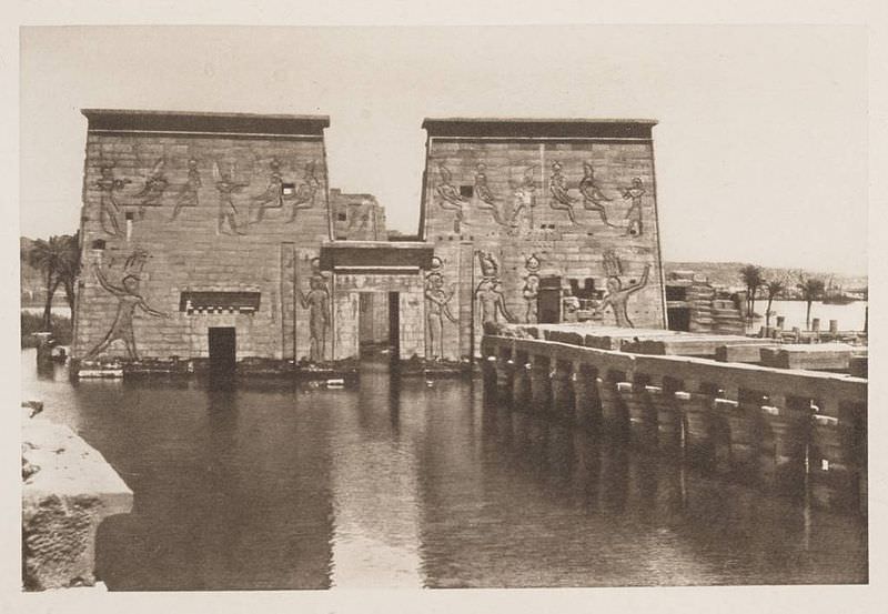
 The flooded Temple of Isis on the island of Philae circa 1905. ( Credit: Wikimedia Commons under an Attribution-Share Alike 2.5 license. Author H.W. Dunning).
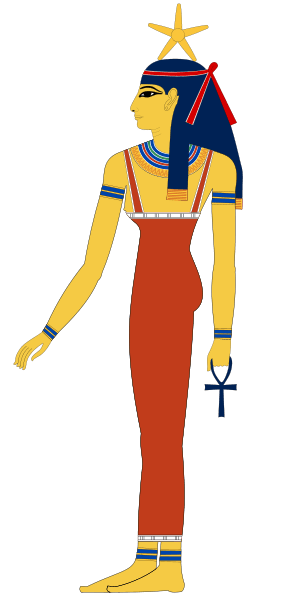
Sirius was a key star for Egyptian astronomers. Identified with the goddess Isis, the Egyptian name for Sirius was Sopdet, the deification of Sothis. There is a line penned by the Greco-Roman scholar Plutarch which states:
“The soul of Isis is called ‘Dog’ by the Greeks.”
Political commentary? A mis-translation by Greek scholars? Whatever the case, the mythological transition from “Isis to Sothis to Dog Star” seems to have been lost in time.
These astronomer-priests noted that Sirius rose with the Sun just prior to the annual flooding of the Nile. The appearance of a celestial object at sunrise is known as a heliacal rising. If you can recover Sirius from behind the glare of the Sun, you know that the “Tears of Isis” are on their way, in the form of life-giving flood waters.
 Sopdet as the personification of Sirius (note the star on the forehead) Wikimedia Commons image under an Attribution Share Alike 3.0 license. Author Jeff Dahl).
In fact, the ancient Egyptians based their calendar on the appearance of Sirius and what is known as the Sothic cycle, which is a span of 1,461 sidereal years (365.25 x 4) in which the heliacal rising once again “syncs up” with the solar calendar.
It’s interesting to note that in 3000 BC, the heliacal rising of Sirius and the flooding of the Nile occurred around June 25th, near the summer solstice. This also marked the Egyptian New Year. Today it occurs within a few weeks of August 15th, owing to precession. (More on that in a bit!)
By the time of the Greeks, we start to see Sirius firmly referred to as the Dog Star. In Homer’s Iliad, King Priam refers to an advancing Achilles as:
“Blazing as the star that cometh forth at Harvest-time, shining forth amid the host of stars in the darkness of the night, the star whose name men call Orion’s Dog”
The Romans further promoted the canine branding for Sirius. You also see references to the “Dog Star” popping up in Virgil’s Aenid.
Over the years, scholars have also attempted to link the dog-headed god Anubis to Sirius. This transition is debated by scholars, and in his Star Names: Their Lore and Meaning, Richard Hinckley Allen casts doubt on the assertion.
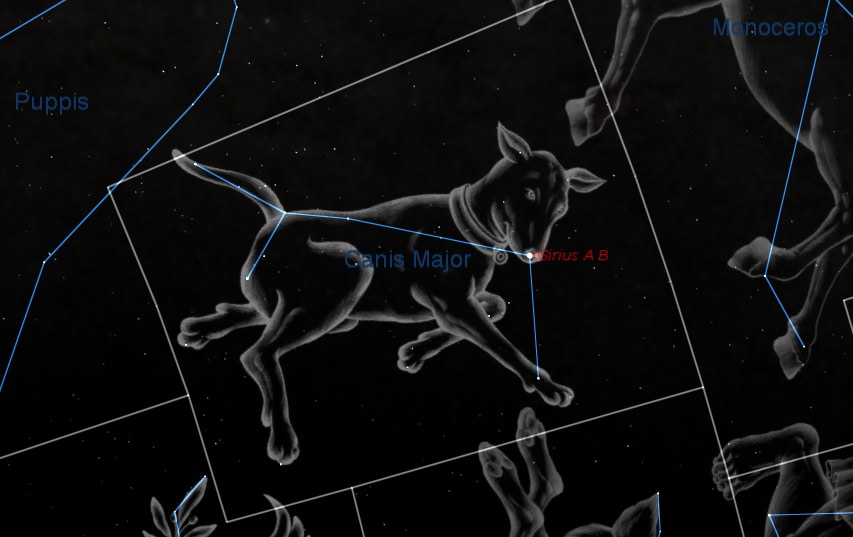
 Sirius as the shining “nose” of the constellation Canis Major. (Created by the author using Starry Night).
Ancient cultures also saw the appearance of Sirius as signifying the onset of epidemics. Their fears were well founded, as summer flooding would also hatch a fresh wave of malaria and dengue fever-carrying mosquitoes.
Making a seasonal sighting of Sirius is fun and easy to do. The star is currently low to the southeast in the dawn, and rises successively higher each morning as August rolls on.
The following table can be used to aid your quest in Sirius-spotting.
|
Latitude north
|
Theoretical date when Sirius can 1st be spotted
|
|
32°
|
August 3rd
|
|
33°
|
August 4th
|
|
34°
|
August 5th
|
|
35°
|
August 6th
|
|
36°
|
August 7th
|
|
37°
|
August 8th
|
|
38°
|
August 9th
|
|
39°
|
August 10th
|
|
40°
|
August 11th
|
|
41°
|
August 12th
|
|
42°
|
August 13th
|
|
43°
|
August 14th
|
|
44°
|
August 15th
|
|
45°
|
August 16th
|
|
46°
|
August 17th
|
|
47°
|
August 18th
|
|
48°
|
August 19th
|
|
49°
|
August 20th
|
|
50°
|
August 21st
|
Thanks to “human astronomical computer extraordinaire” Ed Kotapish for the compilation!
Note that the table above is perpetual for years in the first half of the 21st century. Our friend, the Precession of the Equinoxes pivots the equinoctial points to the tune of about one degree every 72 years. The Earth’s axis completes one full “wobble” approximately every 26,000 years. Our rotational pole only happens to be currently pointing at Polaris in our lifetimes. Its closest approach is around 2100 AD, after which the north celestial pole and Polaris will begin to drift apart. Mark your calendars—Vega will be the pole star in 13,727 AD. And to the ancient Egyptians, Thuban in the constellation Draco was the Pole Star!
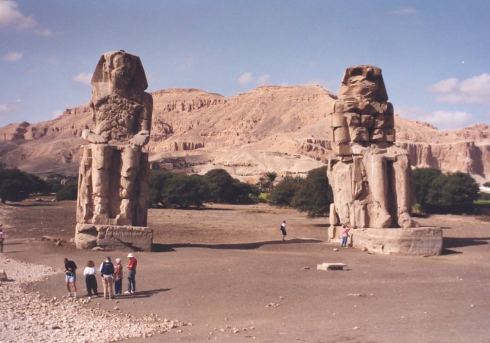
 The Colossi of Memnon Near Luxor, just one of the amazing architectural projects carried out by the ancient Egyptians. (Photo by author).
Keep in mind, atmospheric extinction is your enemy in this quest, as it will knock normally brilliant magnitude -1.46 Sirius a whopping 40 times in brightness to around magnitude +2.4.
Note that we have a nice line-up of planets in the dawn sky (see intro chart), which are joined by a waning crescent Moon this weekend. Jupiter and Mars ride high about an hour before sunrise, and if you can pick out Mercury at magnitude -0.5 directly below them, you should have a shot at spotting Sirius far to the south.
And don’t be afraid to “cheat” a little bit and use binoculars in your quest… we’ve even managed on occasion to track Sirius into the broad daylight. Just be sure to physically block the Sun behind a building or hill before attempting this feat!
 Sirius as seen via Hubble- can you spy Sirius B? (Credit: NASA/ESA Hubble image).
Of course, the heliacal rising of Sirius prior to the flooding of the Nile was a convenient coincidence that the Egyptians used to their advantage. The ancients had little idea as to what they were seeing. At 8.6 light-years distant, Sirius is the brightest star in Earth’s sky during the current epoch. It’s also the second closest star visible to the naked eye from Earth. Only Alpha Centauri, located deep in the southern hemisphere sky is closer. The light you’re seeing from Sirius today left in early 2005, back before most of us had Facebook accounts.
Sirius also has a companion star, Sirius B. This star is the closest example of a white dwarf. Orbiting its primary once every 50 years, Sirius B has also been the center of a strange controversy we’ve explored in past writings concerning Dogon people of Mali.
Sirius B is difficult to nab in a telescope, owing to dazzling nearby Sirius A. This feat will get easier as Sirius B approaches apastron with a max separation of 11.5 arc seconds in 2025.
Some paleoastronomers have also puzzled over ancient records referring to Sirius as “red” in color. While some have stated that this might overturn current astrophysical models, a far more likely explanation is its position low to the horizon for northern hemisphere observers. Many bright stars can take on a twinkling ruddy hue when seen low in the sky due to atmospheric distortion.
 Let the Dog Days of Summer (& astronomy) begin! (Photo by author).
All great facts to ponder during these Dog Days of early August, perhaps as the sky brightens during the dawn and your vigil for the Perseid meteors draws to an end!
https://www.universetoday.com/tag/nile-flooding-sirius/ |
|
|
|
Reply |
Message 34 of 39 on the subject |
|

Welcome | Time Rivers | Book | The Nile Decoded | Etemenanki
Welcome to the Realm of
the Time Rivers
By Goro Adachi
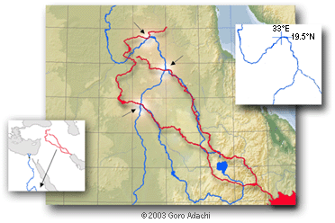
What Is the ‘Time River Theory’?
It’s about the discovery of an astounding system of literal ‘rivers of time’, which may even be described as the ‘fingerprints of the gods’. It is a planetary ‘Rosetta Stone’ for decoding history or even ‘reality’ itself. Sounds overly grandiose? Yes, but it’s not necessarily an exaggeration given the nature of the discovery.
Proving the existence of the ‘Time Rivers’ has explosive implications. And the claim here is that this has indeed been done. But that’s just the beginning of the story. What the ‘Time Rivers’ tell us - about who we are and everything else - is equally, if not more, profound.
The Time River Theory (TRT) is ultimately about the discovery and decoding of the ‘blueprint’ of reality - a blueprint that was literally carved on this planet by an unknown high intelligence. This is a brand new field just activated in 2003 via the publication of The Time Rivers. It’s about time we opened up the Gateway... to a new dimension.
To get a little more specific, here is an abbreviated list of what the Time River Theory is about and what it reveals (at least in the book The Time Rivers):
 A grand system of literal ‘rivers of time’ flowing on our planet, created by some mysterious, higher intelligence. - The intricate ‘Time River scheme’ produced by the Nile, Tigris-Euphrates, Mississippi, etc. showing us the entire timeline of human civilization, both past and future.
- Solutions to deep ancient mysteries of Egypt, Sumer, and even Mars.
- Encoded ‘messages’ revealing extraterrestrial and/or extra-temporal origins of human civilization.
- The 21st century being specifically pinpointed as the edge of time, when a ‘timegate’ opens up to bring mankind back to the realm of ‘Genesis’.
- Tangible and unique solutions to the biblical events of Genesis such as Creation, the fallen angels, the Great Flood, the Ark, etc.
- An encoded timeline of the United States anticipating ‘9/11’, an event suggested to mark the ‘end’ of the United States.
Please note that the the theory is extensive and still rapidly evolving, thus the above should be viewed as only the tip of the iceberg.
To learn more about the TRT, please see The Nile Decode - a paper posted online revealing the basic components of the thesis.
Current Status
A lot of very positive feedback has been received from those who have read The Time Rivers and/or The Nile Decoded. Some samples are posted here.
What about the reaction of the 'alternative history' crowd? How are they responding to the 'quantum leap' that the TRT would represent to their field? The answer to this question is not yet clear since the theory was revealed only recently and is not yet widely known. But the anticipation here is that the reaction would be more or less mixed. Because the Time River Theory is something that radically shifts the whole paradigm, there will probably be those in the field who are perhaps just too 'old' (at least mentally) to keep up with the sudden and rapid movement forward. And this is fine; the Time River system is a discovery for a new generation of truth seekers who maintain a fresh mind capable of clear and creative thinking.
There is actually so much more to the Time River scheme than made available so far (including the book), which is undoubtedly contributing to the tone of confidence expressed here. Hopefully there are many of you who can intuitively sense this 'energy' lurking just beneath the surface... It's all getting ready to come out now. If not already, please study the available material, understand the implications, and... well, join the revolution!
Available Material:
|
|
|
|
Reply |
Message 35 of 39 on the subject |
|
Slightly less direct, but equally telling is the 9/11 connection:
-
The date September 11 in the Gregorian calendar used today almost always coincides with the New Year's Day for the Ethiopian and Coptic or Christian-Egyptian calendars. The ancient Egyptian New Year's Day ('1st of Thoth') was originally set to mark the heliacal rising of Sirius which today takes place around August 6 Gregorian (as viewed from Giza/Cairo). So it can easily be said that August 6 is September 11!
-
As revealed in the recent public 9/11 Commission hearings (spring '04), the President of the United States was explicitly warned of an imminent al-Qaeda terrorist attack inside the US in a PDB (Presidential Daily Brief) memo dated August 6, '01. This was only a month before 9/11 and yet the White House inexplicably took no preventive actions. This was and still is one of the biggest controversies to come out of the official 9/11 investigation so far.
There is a connection between 9/11 and Mars to underscore the emerging nature of the date, Aug. 6.
https://www.goroadachi.com/etemenanki/lucifer-timecode.htm |
|
|
|
Reply |
Message 36 of 39 on the subject |
|
|
|
|
Reply |
Message 37 of 39 on the subject |
|
|
|
|
Reply |
Message 38 of 39 on the subject |
|
Modo IA Todo Imágenes Vídeos Noticias Maps Shopping Libros Vuelos Finance La supuesta conexión entre el río Mississippi y el río Nilo en el contexto de las profecías bíblicas proviene de una teoría conspirativa de Internet y revisionismo histórico alternativo. El núcleo de este argumento se basa en la interpretación literal del versículo de Isaías 11:15: "Y secará Jehová la lengua del mar de Egipto; y levantará su mano con fuerza de su viento sobre el río, y lo herirá en sus siete brazos, y hará que pasen por él con calzado." A continuación se detalla cómo los defensores de esta teoría vinculan ambos ríos y qué dice la realidad histórica y teológica: El argumento de la teoría alternativa Los "siete brazos" o "siete afluentes": Quienes difunden esta hipótesis en redes sociales afirman que el río Nilo actual (en África) no cuenta formalmente con siete ramificaciones principales activas en su geografía moderna, mientras que el sistema del río Mississippi en los Estados Unidos cuenta con siete grandes afluentes o canales principales. La hipótesis de "La América Bíblica": A partir de esta premisa geográfica, defensores de teorías marginales sugieren que la verdadera tierra donde ocurrieron los eventos del Antiguo Testamento (incluyendo el Éxodo y las plagas de Egipto) fue en realidad el continente americano. Bajo esta lógica, aseguran que el río Mississippi es el "verdadero Nilo" de las escrituras y que el Golfo de México equivale al "Mar de Egipto". La realidad histórica, geográfica y teológica Para la comunidad de historiadores, arqueólogos y teólogos académicos, esta teoría carece de cualquier fundamento por las siguientes razones: El Delta del Nilo en la Antigüedad: Históricamente, en la época en que se escribió el libro de Isaías, el Delta del Nilo en el Bajo Egipto sí se abría en siete brazos o canales principales conocidos (los brazos Pelusíaco, Tanítico, Mendésico, Phatnítico, Sebenítico, Bolbítico y Canópico). Con el paso de los siglos, la sedimentación y la intervención humana redujeron el delta a los dos brazos principales que fluyen hoy en día (Damieta y Rosetta). La profecía se refería directamente al contexto geográfico del antiguo Egipto. Simbolismo bíblico: En la teología bíblica, el número siete representa la perfección, la totalidad o la intervención celestial completa. La mención de herir un río en sus "siete brazos" es una metáfora que indica que Dios desarmará por completo las barreras naturales para permitir que su pueblo regrese sin dificultad de su cautiverio. Biblical Hermeneutics Stack Exchange +3 Traducciones alternativas (El Éufrates): Dependiendo de la traducción o manuscrito, muchos eruditos señalan que "el Río" (Ha-Nahar) con mayúscula en ese pasaje de Isaías hace referencia en realidad al río Éufrates, el cual Dios dividiría en siete corrientes menores para que los exiliados israelitas pudieran cruzarlo caminando en sandalias desde Asiria. La relación entre el Mississippi y el Nilo es una asociación geográfica forzada por corrientes de internet que buscan reinterpretar las profecías bíblicas ignorando el contexto geopolítico e histórico del antiguo Medio Oriente. ¿Te gustaría profundizar en el contexto histórico de cómo se distribuía el Delta del Nilo en la antigüedad, o preferís explorar el significado simbólico del río Éufrates en las profecías de Isaías y el Apocalipsis? The alleged connection between the Mississippi River and the Nile River in the context of biblical prophecies stems from an Internet conspiracy theory and alternative historical revisionism. The core of this argument is based on a literal interpretation of Isaiah 11:15: "The Lord will dry up the gulf of the Egyptian sea; with a scorching wind he will sweep his hand over the Euphrates River. He will break it up into seven streams so that anyone can cross over in sandals." (Note: Some translations use "the River" instead of Euphrates). Here is a breakdown of how proponents of this theory link both rivers, contrasted with historical and theological reality: The Alternative Theory Argument The "seven streams" or "seven tributaries": Those who spread this hypothesis on social media claim that the modern Nile River (in Africa) does not formally have seven active main branches today, whereas the Mississippi River system in the United States features seven major tributaries or main channels. The "Biblical America" Hypothesis: Based on this geographical premise, defenders of fringe theories suggest that the actual land where Old Testament events occurred (including the Exodus and the Plagues of Egypt) was actually the American continent. Under this logic, they claim the Mississippi River is the "true Nile" of the scriptures and that the Gulf of Mexico is the equivalent of the "Egyptian Sea." Historical, Geographical, and Theological Reality For historians, archaeologists, and academic theologians, this theory lacks any factual basis for the following reasons: The Ancient Nile Delta: Historically, during the time the Book of Isaiah was written, the Nile Delta in Lower Egypt did open into seven main branches or channels (the Pelusiac, Tanitic, Mendesian, Phatnitic, Sebennytic, Bolbitine, and Canopic branches). Over centuries, sedimentation and human intervention reduced the delta to the two main branches that flow today (Damietta and Rosetta). The prophecy was directly referencing the geographical context of ancient Egypt. Biblical Symbolism: In biblical theology, the number seven represents perfection, completeness, or absolute divine intervention. Mentioning the striking of a river into "seven streams" is a metaphor indicating that God would completely dismantle natural barriers to allow His people to return from captivity without difficulty. Alternative Translations (The Euphrates): Depending on the translation or manuscript, many scholars point out that "the River" (Ha-Nahar) in this passage of Isaiah actually refers to the Euphrates River. The prophecy implies God would divide it into seven smaller streams so that Israelite exiles could walk across it in sandals when returning from Assyria. The relationship between the Mississippi and the Nile is a geographical association forced by internet trends that attempt to reinterpret biblical prophecies by ignoring the geopolitical and historical context of the ancient Middle East. Would you like to delve deeper into the historical context of how the Nile Delta was distributed in antiquity, or would you prefer to explore the symbolic meaning of the Euphrates River in the prophecies of Isaiah and Revelation? La prétendue connexion entre le fleuve Mississippi et le Nil dans le contexte des prophéties bibliques est issue d'une théorie du complot sur Internet et d'un révisionnisme historique alternatif. Le cœur de cet argument repose sur une interprétation littérale du verset d'Isaïe 11:15 : « L'Éternel desséchera la langue de la mer d'Égypte, et il lèvera sa main sur le fleuve, en soufflant avec force : il le partagera en sept canaux, et on le traversera avec des souliers. » Voici comment les partisans de cette théorie lient les deux fleuves, face à la réalité historique et théologique : L'argument de la théorie alternative Les « sept canaux » ou « sept affluents » : Ceux qui propagent cette hypothèse sur les réseaux sociaux affirment que le Nil actuel (en Afrique) ne possède plus formellement sept branches principales actives, tandis que le système du fleuve Mississippi aux États-Unis compte sept affluents majeurs ou canaux principaux. L'hypothèse de « L'Amérique biblique » : À partir de cette prémisse géographique, les défenseurs de théories marginales suggèrent que la véritable terre où se sont déroulés les événements de l'Ancien Testament (y compris l'Exode et les plaies d'Égypte) était en réalité le continent américain. Selon cette logique, ils soutiennent que le Mississippi est le « vrai Nil » des Écritures et que le golfe du Mexique équivaut à la « mer d'Égypte ». La réalité historique, géographique et théologique Pour la communauté des historiens, archéologues et théologiens universitaires, cette théorie est totalement dénuée de fondement pour les raisons suivantes : Le delta du Nil dans l'Antiquité : Historiquement, à l'époque où le livre d'Isaïe a été écrit, le delta du Nil dans la Basse-Égypte se divisait bien en sept branches ou canaux principaux (les branches Pélusiaque, Tanitique, Mendésienne, Phatnitique, Sebennytique, Bolbitine et Canopique). Au fil des siècles, l'envasement et l'intervention humaine ont réduit le delta aux deux branches principales actuelles (Damiette et Rosette). La prophétie faisait directement référence au contexte géographique de l'Égypte ancienne. Le symbolisme biblique : Dans la théologie biblique, le chiffre sept représente la perfection, la plénitude ou l'intervention divine totale. Mentionner le fait de frapper un fleuve pour le diviser en « sept canaux » est une métaphore indiquant que Dieu détruira complètement les barrières naturelles pour permettre à son peuple de revenir de captivité sans difficulté. Traductions alternatives (L'Euphrate) : Selon les traductions ou les manuscrits, de nombreux érudits soulignent que « le Fleuve » (Ha-Nahar) avec une majuscule dans ce passage d'Isaïe fait en réalité référence à l'Euphrate. La prophétie implique que Dieu le diviserait en sept courants mineurs afin que les exilés israélites puissent le traverser à pied sec en sandales depuis l'Assyrie. La relation entre le Mississippi et le Nil est une association géographique forcée par des tendances Internet qui tentent de réinterpréter les prophéties bibliques en ignorant le contexte géopolitique et historique du Proche-Orient ancien. Si vous le souhaitez, précisez-moi si vous voulez : Approfondir l'histoire de la géographie du delta du Nil dans l'Antiquité. Explorer le rôle prophétique de l'Euphrate dans la Bible. Traduire ce texte dans une autre langue. La respuesta del Modo IA está lista |
|
|
|
Reply |
Message 39 of 39 on the subject |
|
Modo IA Todo Imágenes Vídeos Noticias Maps Shopping Libros Vuelos Finance La conexión entre Francia, Luisiana, Nueva Orleans y el río San Lorenzo constituye el eje geográfico y político del imperio colonial conocido como la Nueva Francia. Esta red de territorios y vías fluviales estuvo en el centro de las tensiones que desencadenaron y resolvieron la Guerra de los Siete Años (1756-1763) en el continente norteamericano. Wikipedia +3 New France vs English Colonies — Map post ????️????????????????⚔️???? This ... The Seven Years' War and its impact on North America French and Indian War - Wikipedia New France vs English Colonies — Map post ????️????????????????⚔️???? This ... French colonization of the Americas - Wikipedia New France vs English Colonies — Map post ????️????????????????⚔️???? This ... ????️ La conexión geográfica: El imperio de las aguas Durante los siglos XVII y XVIII, Francia construyó un imperio continental estratégico en América del Norte basado en el control de las grandes cuencas hidrográficas: Wikipedia El río San Lorenzo: Era la puerta de entrada al norte y el corazón de la colonia de Canadá. A lo largo de sus riberas se fundaron ciudades clave como Quebec y Montreal. Wikipedia +1 Los Grandes Lagos: Funcionaron como el enlace natural que permitía a los exploradores, comerciantes de pieles y misioneros franceses transitar desde la cuenca del San Lorenzo hacia el interior del continente. Elon.io +1 El río Misisipi y la Luisiana: Al conectar los Grandes Lagos con el río Misisipi, los franceses reclamaron un gigantesco territorio interior al que llamaron Luisiana. The Hispanic Council +1 Nueva Orleans: Fundada en 1718 en la desembocadura del Misisipi, se convirtió en el puesto de control comercial y militar definitivo del Golfo de México. Wikipedia +1 Esta inmensa red conector permitió a Francia rodear geográficamente a las Trece Colonias británicas, que estaban limitadas a la costa atlántica al este de los montes Apalaches. ⚔️ Relación con la Guerra de los Siete Años La competencia por expandir y conectar estos territorios fue la causa directa de la guerra, y su desenlace reconfiguró por completo el mapa de América: U.S. Department of State (.gov) 1. El detonante: Unir el imperio francés El conflicto en Norteamérica (conocido allí como la Guerra Franco-Indígena) comenzó antes del estallido europeo, en 1754. Francia buscaba levantar fuertes militares en el valle del río Ohio para asegurar una conexión terrestre y fluvial fluida entre el río San Lorenzo (Canadá) y el Misisipi (Luisiana). Los colonos británicos vieron esto como una amenaza directa a su propia expansión hacia el oeste, lo que encendió los primeros enfrentamientos armados. Wikipedia +3 2. Las vías fluviales como teatros de batalla Durante la guerra, el control del río San Lorenzo fue el objetivo estratégico central británico. Al ser la única vía de abastecimiento desde Francia hacia el norte, su caída significaba el colapso del imperio. En 1759, las fuerzas británicas capturaron Quebec tras remontar el río, y en 1760 cayó Montreal, sellando el destino de la presencia francesa en Canadá. YouTube ·The Woodland Escape +1 3. El Tratado de París (1763) y el fin de la Nueva Francia Tras ser derrotada, Francia se vio obligada a desmantelar por completo su red colonial norteamericana a través de acuerdos internacionales: The Hispanic Council +1 Cesión a Gran Bretaña: Francia entregó todo el Canadá (la cuenca del San Lorenzo) y todos sus territorios al este del río Misisipi. Cesión a España: Para evitar que cayera en manos británicas y compensar a su aliado por las pérdidas en la guerra, Francia cedió secretamente el territorio de la Luisiana al oeste del Misisipi, incluyendo la estratégica ciudad de Nueva Orleans, mediante el Tratado de Fontainebleau (1762), ratificado en la paz de 1763. History.com +2 Con este reajuste histórico, Francia quedó prácticamente expulsada del continente, dejando el control del río San Lorenzo en manos británicas y el puerto de Nueva Orleans temporalmente bajo soberanía española. StudySmarter ES +1 Si te interesa profundizar en esta etapa, contame: ¿Querés saber más sobre cómo reaccionaron los colonos franceses de Nueva Orleans al pasar a control español? ¿Te gustaría conocer los detalles de la caída de Quebec en el río San Lorenzo? ¿Buscás información sobre cómo este mapa volvió a cambiar con la Compra de Luisiana en 1803? The connection between France, Louisiana, New Orleans, and the St. Lawrence River formed the geographic and political backbone of the colonial empire known as New France. This network of territories and waterways was at the very heart of the tensions that triggered and resolved the Seven Years' War (1756–1763) on the North American continent. ????️ The Geographic Connection: An Empire of Waterways During the 17th and 18th centuries, France built a massive continental empire in North America by gaining control of its major river basins: The St. Lawrence River: This was the gateway to the north and the heart of the colony of Canada. Major settlements like Quebec and Montreal were founded along its banks. The Great Lakes: They served as the natural link that allowed French explorers, fur traders, and missionaries to travel from the St. Lawrence basin into the interior of the continent. The Mississippi River and Louisiana: By connecting the Great Lakes to the Mississippi River, the French claimed a vast interior territory they named Louisiana. New Orleans: Founded in 1718 at the mouth of the Mississippi, it became the ultimate commercial and military checkpoint controlling access to the Gulf of Mexico. This immense interconnected network allowed France to geographically encircle the British Thirteen Colonies, which were pinned to the Atlantic coast east of the Appalachian Mountains. ⚔️ Relationship with the Seven Years' War The competition to expand and link these territories was the direct cause of the war, and its outcome completely reshaped the map of America: 1. The Trigger: Securing the French Connection The conflict in North America (known there as the French and Indian War) began in 1754, before fighting broke out in Europe. France sought to build military forts in the Ohio River Valley to secure a seamless land and river connection between the St. Lawrence River (Canada) and the Mississippi (Louisiana). British colonists saw this as a direct threat to their own westward expansion, sparking the first armed clashes. 2. Waterways as Battlegrounds During the war, controlling the St. Lawrence River was Britain's central strategic objective. As the only supply route from France to the north, its fall meant the collapse of the empire. In 1759, British forces captured Quebec after sailing up the river, and Montreal fell in 1760, sealing the fate of the French presence in Canada. 3. The Treaty of Paris (1763) and the End of New France Following its defeat, France was forced to completely dismantle its North American colonial network through international treaties: Cession to Great Britain: France surrendered all of Canada (the St. Lawrence basin) and all of its territories east of the Mississippi River. Cession to Spain: To prevent it from falling into British hands and to compensate its ally for losses in the war, France secretly ceded the Louisiana territory west of the Mississippi, including the strategic city of New Orleans, through the Treaty of Fontainebleau (1762), which was ratified in the 1763 peace agreement. With this historic realignment, France was virtually expelled from the continent, leaving the St. Lawrence River under British control and the port of New Orleans temporarily under Spanish sovereignty. If you would like to explore this topic further, please let me know: Would you like to know more about how French colonists in New Orleans reacted to coming under Spanish rule? Are you interested in the details of the Fall of Quebec along the St. Lawrence River? Do you want to see how this map changed again with the Louisiana Purchase in 1803? La connexion entre la France, la Louisiane, La Nouvelle-Orléans et le fleuve Saint-Laurent constituait l'axe géographique et politique de l'empire colonial connu sous le nom de Nouvelle-France. Ce réseau de territoires et de voies navigables fut au cœur des tensions qui ont déclenché et résolu la guerre de Sept Ans (1756-1763) sur le continent nord-américain. ????️ La connexion géographique : l'Empire des eaux Aux XVIIe et XVIIIe siècles, la France a bti un immense empire continental en Amérique du Nord en prenant le contrôle de ses principaux bassins hydrographiques : Le fleuve Saint-Laurent : C'était la porte d'entrée vers le nord et le cœur de la colonie du Canada. Des villes clés comme Québec et Montréal ont été fondées le long de ses rives. Les Grands Lacs : Ils servaient de lien naturel permettant aux explorateurs, coureurs des bois et missionnaires français de passer du bassin du Saint-Laurent à l'intérieur du continent. Le fleuve Mississippi et la Louisiane : En reliant les Grands Lacs au fleuve Mississippi, les Français ont revendiqué un gigantesque territoire intérieur qu'ils ont nommé Louisiane. La Nouvelle-Orléans : Fondée en 1718 à l'embouchure du Mississippi, elle est devenue le poste de contrôle commercial et militaire stratégique pour l'accès au golfe du Mexique. Cet immense réseau interconnecté permettait à la France d'encercler géographiquement les Treize Colonies britanniques, qui étaient limitées à la côte atlantique, à l'est des montagnes Appalaches. ⚔️ Relation avec la guerre de Sept Ans La rivalité pour étendre et relier ces territoires fut la cause directe de la guerre, et son dénouement a complètement redessiné la carte de l'Amérique : 1. Le déclencheur : sécuriser la liaison française Le conflit en Amérique du Nord (connu là-bas sous le nom de guerre de la Conquête ou guerre franco-indienne) a débuté en 1754, avant le déclenchement des hostilités en Europe. La France cherchait à construire des forts militaires dans la vallée de l'Ohio pour assurer une liaison terrestre et fluviale continue entre le fleuve Saint-Laurent (Canada) et le Mississippi (Louisiane). Les colons britanniques y ont vu une menace directe pour leur propre expansion vers l'ouest, ce qui déclencha les premiers affrontements armés. 2. Les voies navigables comme thétres de bataille Pendant la guerre, le contrôle du fleuve Saint-Laurent devint l'objectif stratégique central des Britanniques. S'agissant de l'unique voie de ravitaillement depuis la France vers le nord, sa chute signifiait l'effondrement de l'empire. En 1759, les forces britanniques s'emparèrent de Québec après avoir remonté le fleuve, et Montréal tomba en 1760, scellant le sort de la présence française au Canada. 3. Le traité de Paris (1763) et la fin de la Nouvelle-France Après sa défaite, la France fut contrainte de démanteler entièrement son réseau colonial nord-américain par le biais de traités internationaux : Cession à la Grande-Bretagne : La France abandonna tout le Canada (le bassin du Saint-Laurent) et tous ses territoires situés à l'est du fleuve Mississippi. Cession à l'Espagne : Pour éviter qu'elle ne tombe entre les mains des Britanniques et pour compenser les pertes de son allié pendant la guerre, la France céda secrètement le territoire de la Louisiane à l'ouest du Mississippi, y compris la ville stratégique de La Nouvelle-Orléans, par le traité de Fontainebleau (1762), ratifié lors de la paix de 1763. Avec ce remaniement historique, la France fut pratiquement expulsée du continent, laissant le fleuve Saint-Laurent sous contrôle britannique et le port de La Nouvelle-Orléans temporairement sous souveraineté espagnole. Si vous souhaitez approfondir le sujet, dites-moi : Voulez-vous en savoir plus sur la réaction des colons français de La Nouvelle-Orléans face à la domination espagnole ? Êtes-vous intéressé par les détails de la chute de Québec sur le fleuve Saint-Laurent ? Souhaitez-vous découvrir comment cette carte a encore changé avec la vente de la Louisiane en 1803 ? La respuesta del Modo IA está lista |
|
|
 First
Previous
25 a 39 de 39
Next  Last |
|
| |
|
|
©2026 - Gabitos - All rights reserved | |
|
|




















 The flooded Temple of Isis on the island of Philae circa 1905. (Credit: Wikimedia Commons under an Attribution-Share Alike 2.5 license. Author H.W. Dunning).
 Sopdet as the personification of Sirius (note the star on the forehead) Wikimedia Commons image under an Attribution Share Alike 3.0 license. Author Jeff Dahl).
 Sirius as the shining “nose” of the constellation Canis Major. (Created by the author using Starry Night).
 The Colossi of Memnon Near Luxor, just one of the amazing architectural projects carried out by the ancient Egyptians. (Photo by author).
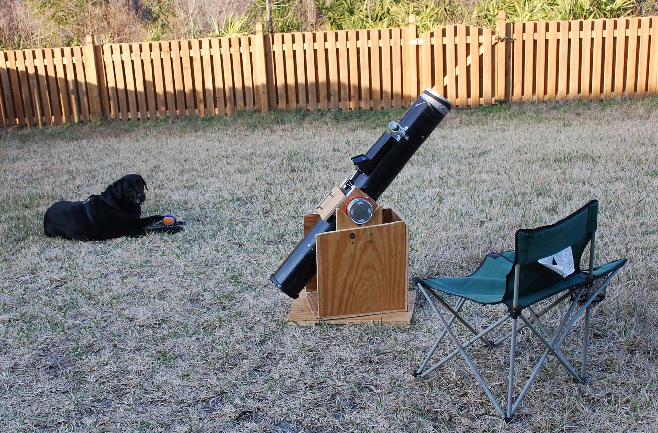 Let the Dog Days of Summer (& astronomy) begin! (Photo by author).