|
|
General: NEIL ARMSTRONG ERA MORMON?
Escolher outro painel de mensagens |
|
|
Don Lind, un Santo de los Últimos Días, fue un investigador de la NASA cuando Estados Unidos comenzó a reclutar astronautas para misiones espaciales.
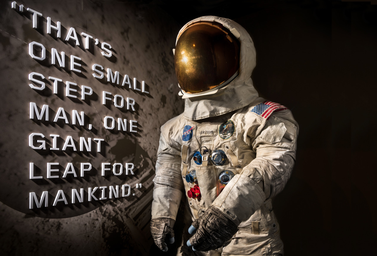
Hace cincuenta años, Neil Armstrong reveló una placa conmemorativa con la inscripción:
“Aquí, los hombres del planeta Tierra pisaron la Luna por primera vez, en julio de 1969. Llegamos en paz en nombre de toda la humanidad.”
Después, Armstrong salió del módulo lunar del Apolo 11, Eagle, y pronunció 12 palabras que pasaron a la historia:
“Un pequeño paso para el hombre, un gran salto para la humanidad.”

El 20 de julio de 1969, la exploración espacial alcanzó nuevas alturas en los cielos cuando Neil Armstrong y Buzz Aldrin dieron un paseo por la luna. En el Mar de la Tranquilidad de la luna, Aldrin colocó una caja en la superficie de la luna, un sismómetro que funciona con energía solar que todavía descansa allí.
El sismómetro fue diseñado por un astronauta Santo de los Últimos Días, Don Lind, quien desempeñó un papel vital en el primer aterrizaje lunar y que por años trabajaría en misiones espaciales.
También te puede interesar: “Cómo seguir adelante a pesar de las dificultades”
Cuando era niño, Don Lind y sus hermanas se treparon a los árboles de su vecindario en Midvale, Utah, moviendo las ramas simulando que estaban en una nave espacial que se lanzaba a través del universo. En ese tiempo, un viaje espacial era una hazaña que sólo se veía en los cómics y en la ciencia ficción.
No fue hasta más de 20 años después que los primeros hombres se aventuraron a lo desconocido y entraron en el espacio en 1961. Después de escuchar las noticias, Lind, en ese entonces un piloto de la Marina con un doctorado en física nuclear de alta energía, sabía que había encontrado su vocación.

Don Lind fue un investigador de la NASA cuando Estados Unidos comenzó a reclutar astronautas para misiones espaciales. La experiencia de Lind como piloto y científico lo hicieron elegible para el programa, y cuando el Apollo 11 empezó su misión, Lind, quien fue puesto a cargo de las operaciones de la superficie lunar, siguió meticulosamente el progreso de los astronautas desde el centro de Control de la Misión de la NASA.
En el caso de que surgieran complicaciones imprevistas mientras Armstrong y Aldrin caminaban por la luna, Lind los guiaría.
“Había elaborado todos los procedimientos y probado todo”, dijo Lind al Salt Lake Tribune. “Yo era, literalmente, el experto.”
Lind también ayudó a diseñar los dos experimentos principales establecidos en el primer aterrizaje lunar (los sismómetros construidos para detectar los terremotos lunares y un retrorreflector de lámina) que respondieron a las preguntas de los misterios de la luna.

El reflector de lámina de metal desplegado en la luna permitió que la NASA usara láseres para medir la distancia entre la superficie de la Tierra y la luna.
Sobre el sismómetro, que revelaría que la luna es una masa sólida sin un interior fundido, Lind le dijo al The Salt Lake Tribune:
“Tan pronto como se desplegó y la luz del sol golpeó los paneles solares, se comenzó a registrar y transmitir señales. Registró como [Aldrin] se alejó para subir a la escalera del módulo lunar, y el clic de la puerta cuando se cerró. ¡Funcionó a la perfección!”
Hoy en día el sismómetro todavía podría estar transmitiendo desde el Mar de la Tranquilidad.
“Es probable que todavía esté transmitiendo”, dijo Lind al Tribune de Salt Lake. “Pero creo que ya nadie lo está escuchando.”

El vuelo espacial de Lind llegó 16 años después, en 1985, cuando abordó el Challenger en un viaje de ocho días para estudiar la Aurora Australis.
Durante esta misión, Lind logró un hito histórico especialmente significativo para los Santos de los Últimos Días. Don Lind se convirtió en el primer hombre en tomar la Santa Cena en el espacio.
Si bien Buzz Aldrin tomó la comunión a bordo del Eagle, el vehículo lunar, y llevó consigo un fragmento de las escrituras a la superficie de la luna, Don Lind fue el primer Santo de los Últimos Días en el espacio y el primero en participar de la Santa Cena en el espacio.
Durante la Conferencia General de octubre de 1985, Lind compartió cómo la exploración en el espacio lo ayudó a acercarlo al cielo:

“Algunos de mis sentimientos personales fueron muy espirituales… La primera vez que tuve unos minutos para detenerme y ver la tierra, la belleza absoluta de esta hizo que los ojos se me llenaran de lagrimas….
Traten de imaginarse lo que fue presenciar esa escena y recordar partes de media docena de Escrituras “Los cielos cuentan la gloria de Dios” (Salmos 19:1.) Si han visto los cielos, han visto “a Dios obrando en su majestad y poder” (DyC 88:47).
Estoy seguro de que pueden imaginarse lo cerca que me sentí de mi Padre Celestial al ver una de Sus bellas creaciones. Ciertamente me conmovió y cobré mas consciencia de lo que el Señor hizo como Creador de nuestra tierra. Esa fue una de las experiencias mas conmovedoras de mi vida.
Otra experiencia que fue muy especial para mi fue participar de la Santa Cena estando en órbita. Estuvimos en el espacio durante toda una semana, y naturalmente pasamos ahí un domingo. Mi obispo me había otorgado permiso para efectuar mi propio servicio sacramental. Fue algo fuera de lo común.
Ustedes presbíteros que me escuchan, imagínense el arrodillarse en ausencia de la gravedad flotando en el aire. Para hacerlo en privado tuve mi reunión sacramental en mi estación para dormir, algo semejante a una litera en un tren.
Me arrodillé en lo que ustedes pensarían es el techo y abrace mi bolsa de dormir para no flotar. Fue una experiencia muy especial.
Toda mi vida recordaré ese servicio sacramental y la renovación de mis convenios bautismales a tanta distancia de la tierra. Ese sentimiento tan especial es el que por lo general se siente cuando uno va al templo.”
Este artículo fue escrito originalmente por Danielle B. Wagner y fue publicado originalmente por ldsliving.com bajo el título “Latter-day Saint Played Key Role Getting Men on the Moon + His Experiment That Is Still on the Moon Today”
https://masfe.org/temas/vida-santos-de-los-ultimos-dias/don-lind-luna-nasa/ |
|
|
|
|

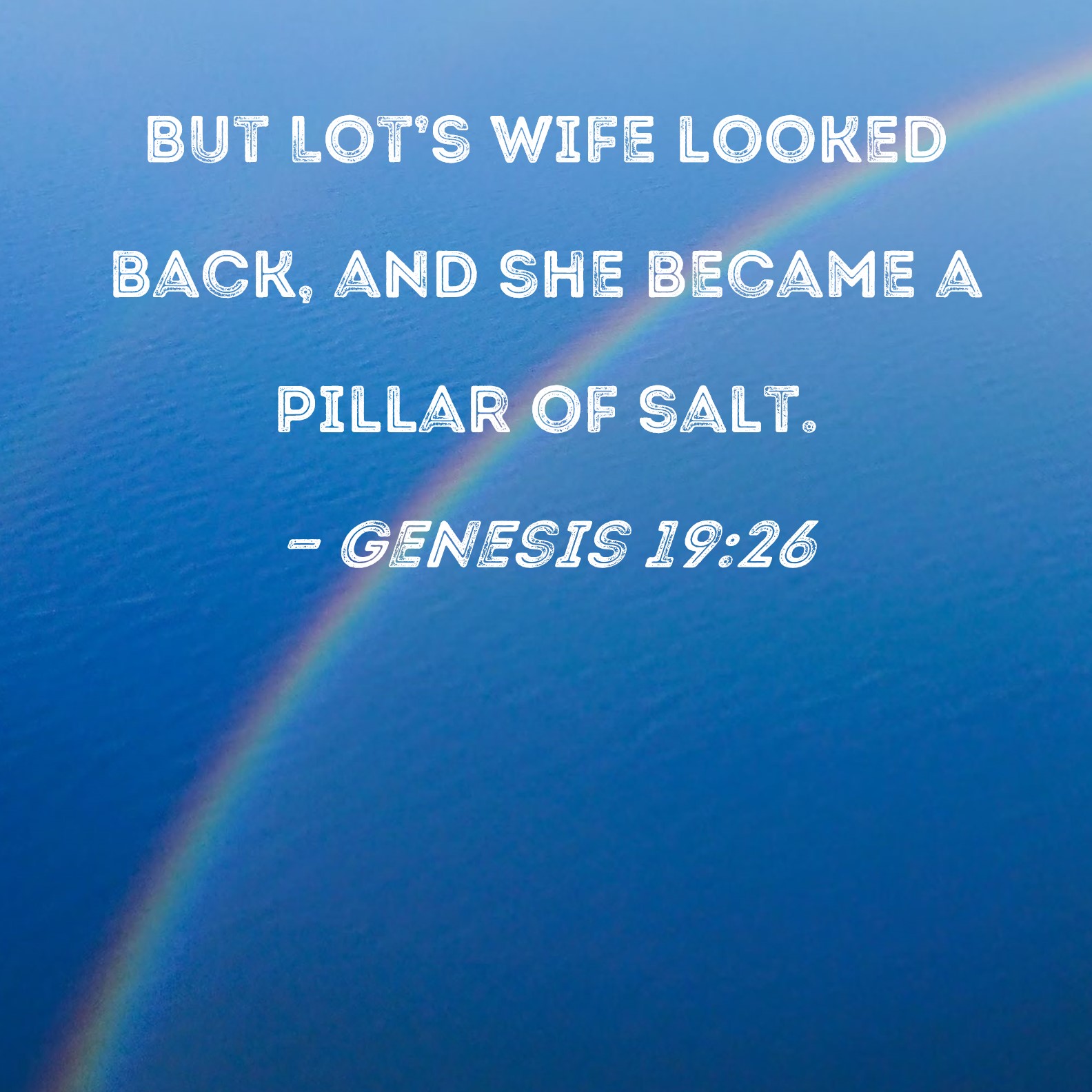
salt lake city=alchemy (salt)=dollar=$= LOT S WIFE(SODOMA AND GOMORRA)
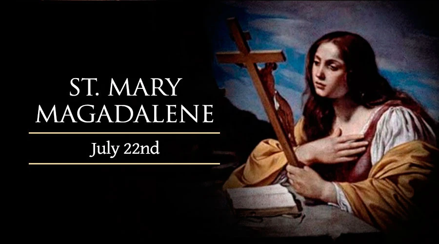
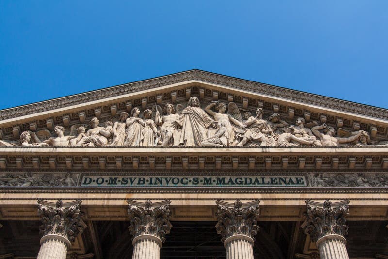
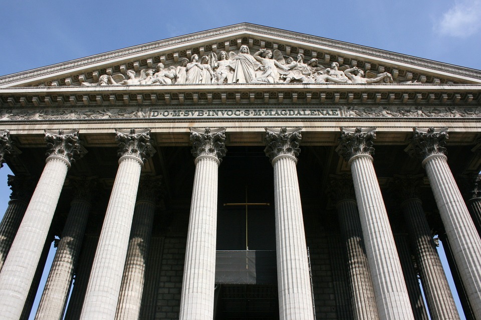
Cathedral of the Madeleine
From Wikipedia, the free encyclopedia
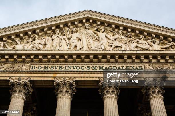
The Cathedral of the Madeleine is a Roman Catholic church in Salt Lake City, Utah, United States. It was completed in 1909 and currently serves as the cathedral, or mother church, of the Diocese of Salt Lake City. It is the only cathedral in the U.S. under the patronage of St. Mary Magdalene.
Description[edit]
The cathedral was built under the direction of Lawrence Scanlan, the first bishop of Salt Lake City, who dedicated it to St. Mary Magdalene.[2] It was designed by architects Carl M. Neuhausen and Bernard O. Mecklenburg. The exterior is predominantly a Neo-Romanesque design, while the inside displays more Neo-Gothic details. Construction began in 1900 and was completed in 1909. It was dedicated by James Cardinal Gibbons, Archbishop of Baltimore.
It is theorized that Bishop Scanlan chose Mary Magdalene as the patron saint of the Diocese of Salt Lake because her feast day is on July 22, two days before Pioneer Day, a celebration commemorating the arrival of the Mormon pioneers in Salt Lake Valley, so that Catholics would have something to celebrate alongside the region's dominant faith.[3]
The interior of the cathedral was created under the direction of Joseph S. Glass, the second bishop of Salt Lake. Bishop Glass enlisted John Theodore Comes, one of the preeminent architects in the country, to decorate the interior of the cathedral. His plans for the interior were largely based upon the Spanish Gothic style. The colorful murals and polychrome were added at this time, as were the ornate shrines. In 1916, Bishop Glass also changed the name of the cathedral to the French spelling after visiting her purported tomb.[2]
In the 1970s, the exterior of the building was restored, and between 1991 and 1993, the interior of the cathedral was renovated and restored under Bishop William K. Weigand. This included not only the removal of dust and dirt and restoration of the interior but also changes to the liturgical elements of the cathedral to bring them into conformity with certain widespread changes in liturgical practice that developed after the Second Vatican Council.
This included constructing a new altar, moving the cathedra, creating a separate chapel for the Blessed Sacrament, and adding an ample baptismal font. The Blessed Sacrament Chapel also contains the tomb of Bishop Scanlan.[4] Resting atop the tomb is a case containing a small relic of Saint Mary Magdalene. The cathedral in Salt Lake City and the Basilica of Saint-Maximin-la-Sainte-Baume in France are the only cathedrals in the world holding first-class relics of the saint and are named in her honor.[5] The major restoration of the interior of the cathedral was accomplished through the vision of Monsignor M. Francis Mannion.[6]
The cathedral is home to the only co-educational Catholic Choir School in the United States. The Madeleine Choir School, established in 1996, now serves over 400 students in Pre-Kindergarten through Grade Eight.[7] The Cathedral Choir has recorded several CDs and routinely tours both nationally and internationally. In addition to singing daily services at the Cathedral of the Madeleine, choristers have sung at St. Peter's Basilica (Vatican City), Notre Dame de Paris (France), and in churches across the United States of America, Spain, Italy, France, Belgium, and Germany, among other places.[8]
Composer Amédée Tremblay notably served as the church's organist from 1920 to 1925.[9]
-
-
Cathedral of the Madeleine, looking east
-
Interior of the cathedral
-
  |
|
|
|
|
Astronomical alignment[edit]
Looking east through nave on 23 June 1976, two days after the summer solstice Mary Magdalene's relics in the crypt
In 1976, Hugues Delautre, one of the Franciscan fathers charged with stewardship of the Vézelay sanctuary, discovered that beyond the customary east-west orientation of the structure, the architecture of La Madeleine incorporates the relative positions of the Earth and the Sun into its design. Every June, just before the feast day of Saint John the Baptist, the astronomical dimensions of the church are revealed as the sun reaches its highest point of the year, at local noon on the summer solstice, when the sunlight coming through the southern clerestory windows casts a series of illuminated spots precisely along the longitudinal center of the nave floor.[13][14][15][16][17]
|
|
|
|
|

Understanding Hebrew Directions – Part IV
Continuing with the previous post on how we can understand Hebrew words and their meaning in order to better understand what Mormon is writing, specifically as it relates to the many directions and his usage of compass directions to describe the Land of Promise, as well as the Point of View of the writer or the subject of the writing. When trying to understand the writing of the ancients, such as Mormon, Nephi, et al., modern man simply cannot seem to come to grips with their point of view, but insists on putting his own thinking into the matter that is so out of alignment with that of the ancients.
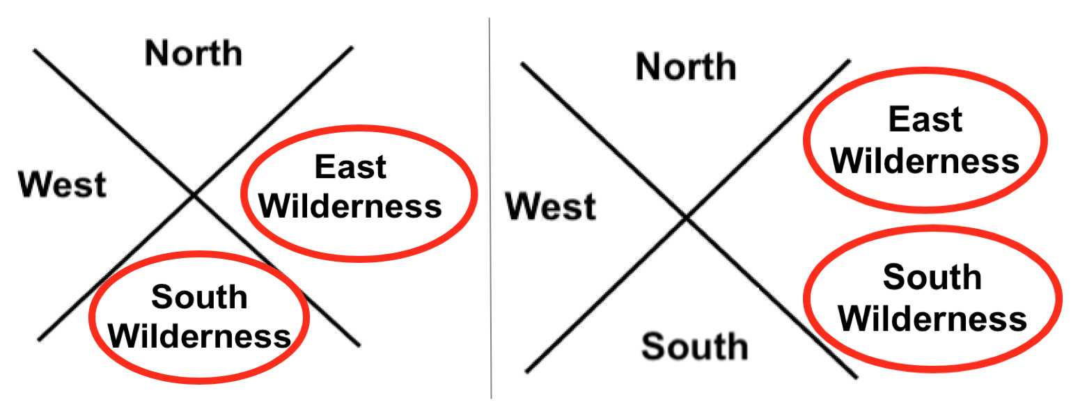
Left: The ancient Hebrews directional system contained eight compass points; Right: Our compass system today contains 32 directions. It is not just that they did not have these divisions, they did not think in terms of such minute directions
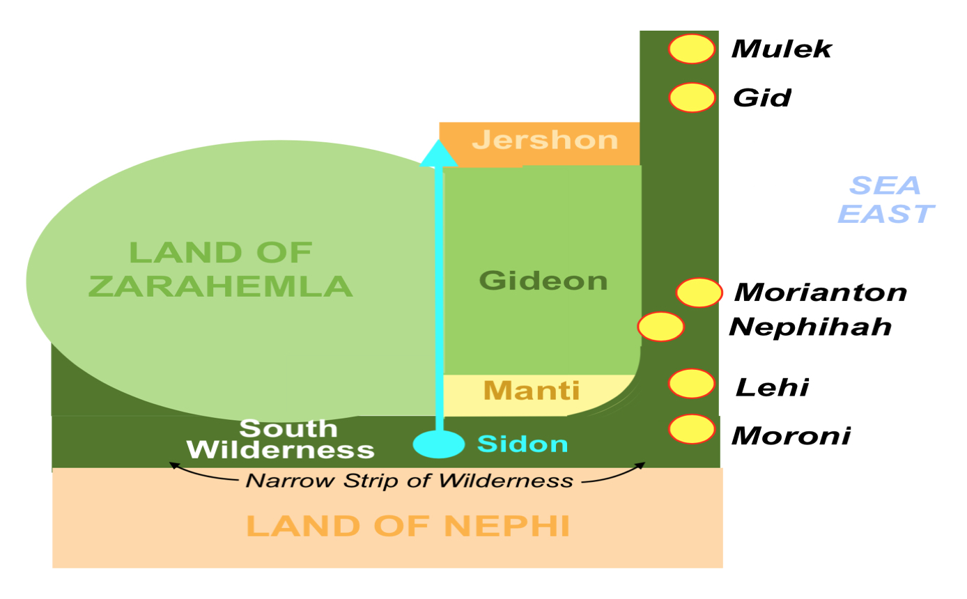
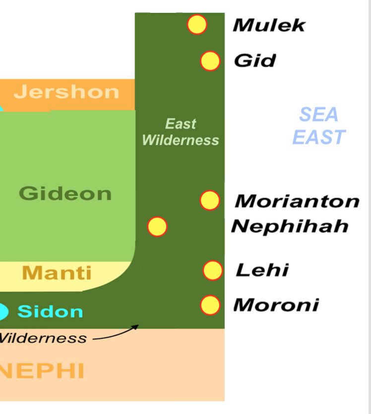
As an example, when it comes to directions, we think in far more divisions of a cardinal point than they did. Their view of their world in the sense of directions was very limited. They had limited need for anything more than the four cardinal directions, north-east-south-west, while we today use far more because we have a far greater geographical setting in our world than did the ancients. Thus, when Mormon describes an East Sea or an East Wilderness, we need to understand that it was in the east and not somewhere else. The same is true with the South Wilderness or a West Wilderness. Consequently, we need to place an East Wilderness and a South Wilderness within their proper north, east, south, and west orientation to the Point of View of the writer, which is the Land of Zarahemla.
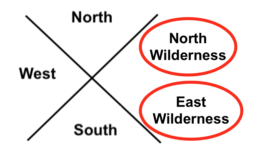
Left: Correct usage of east and west wildernesses; Right: Incorrect. When someone places both the East and South Wilderness in the East, it is simply not something the Hebrews or Nephites would have ever done and never did do
Even if we were more accurate to directions and labeled the east wilderness above as the north wilderness and the south wilderness above as the east wilderness, it would not fit Hebrew thinking.
The problem is, and always is, that the Hebrews/Jews/Nephites did not think the way we think today. First of all, they would never put a north or south anything in the east—the East was a pure direction. It was their entire being, their entire religion base, the way they drew maps, and thought of their universe. Nor would they have doubled up on two directions in a single direction, like the Mesoamericanists’ seas above or the Venice Priddis’ map. It simply would never happen—it simply is not within the Hebrew/Jewish/Nephite mindset to think that way. East of Zarahemla would be an East Wilderness, not a South Wilderness. In fact, everything to the East of Zarahemla (or even Bountiful and Nephi) would be East in Hebrew directional thinking—never anything else.
After the Lamanites were driven out of the “east wilderness” Moroni caused that the Nephites possess the land and build cities in the “east wilderness”
If a theorist places something there, then they are wrong. And if they are going to follow the overall comments of Mormon, the Nephites drove the Lamanites “out of the east wilderness” and shortly after, Mormon states: “when Moroni had driven all the Lamanites out of the east wilderness, which was north of the lands of their own possessions, he caused that the inhabitants who were in the land of Zarahemla and in the land round about should go forth into the east wilderness, even to the borders by the seashore, and possess the land” (Alma 50:9). Mormon then goes on to write: “And thus he cut off all the strongholds of the Lamanites in the east wilderness, yea, and also on the west, fortifying the line between the Nephites and the Lamanites, between the land of Zarahemla and the land of Nephi, from the west sea, running by the head of the river Sidon—the Nephites possessing all the land northward, yea, even all the land which was northward of the land Bountiful, according to their pleasure” (Alma 50:11).

Isn’t it interesting that Mormon does not mention anything about a “south wilderness” where these cities were built and from which Moroni drove out the Lamanites, yet that is exactly where some claim the South Wilderness was located. Also, in the Nephites building a city where the Lamanites had been driven out named “Moroni,” which was near the Land of Nephi, how would the Nephites drive the Lamanites out of the East Wilderness that was unattached to the Land of Nephi, with a “south wilderness” in between. Or build cities along the eastern seacoast just north of the narrow strip of land and the Land of Nephi without a mention of a south wilderness there? Of course, that is not the main point here. The point is and needs to be the basis of anything regarding directions, is the fact, and irrefutable fact, and not one of someone’s interpretation, the Hebrews and Jews, therefore the Nephites who were from that stock, and spoke and wrote Hebrew, would simply not have placed names to wildernesses as some have done. It would have violated their entire thinking process and their entire vision of the world around them. Consider someone living in Los Angeles claiming the Pacific Ocean was to their east. They woud simply laugh at you. Or someone in Salt Lake City claiming the Great Salt Lake was to the southwest, or that St. George was located in northern Utah, or Toole was located in southeast Utah. Claiming that any of these were correct, would simply be rejected by any Utahn, and most anyone else with any knowledge of the state. It would be like someone returning from a visit to Jerusalem and saying that the Muslim Quarter was in the southwestern quadrant of the city, the Dome of the Rock on the Temple Mount was beyond the New Gate into the Christian Quarter, or that the Cathedral of St. James was in the Jewish Quarter. Unless you had been there, lived there, or studied the city, you might accept those comments—but they would be completely incorrect, as any resident of Jerusalem would readily know. What if someone wrote a book about Jerusalem and listed Zion’s Gate as being in the Armenian Quarter, Tanner’s Gate being in the Christian Quarter, Lion’s Gate being in the Muslim Quarter, and the Dung Gate being in the Jewish Quarter? Or stated that Jesus went to the Pool of Siloam in the Upper City, walked along the wall of the Lower City? Would you know if those geographical statements were correct or incorrect? Actually six of those eight statements are geographically wrong. But how would you know that without study? Yet, people pick up a book written by someone, read their theory about the Great Lakes, the Heartland, or eastern U.S. and accept what they say without knowing how inaccurate they are. Some get so interested, they parrot the comments and the beliefs without ever coming to a knowledge of their inaccuracy. When it comes to the directions in the scriptural record, it is imperative to understand that in the ancient world, names did not carry much weight in meaning to a lone traveler or to an individual trying to find his way around an unknown city. However, directional names were readily apparent. You can call something the “water gate,” but calling it the “southeast gate,” means far more. Just like the “Road to the East Sea,” meant far more to someone than “Hezekiah’s Road,” and would be far more likely to know where it was located. The same is true of calling it Nehemiah’s Wall or the “north wall.” The point is, ancient directions are not something to playh around with and make all sorts of absurd claims that might make sense to a modern thinker, but would have been simply unusable and, therefore, not accurate, to the ancient world and ancient-thinking people. Directions were critical to survival, or at least in understanding the world around them. The ancients built elaborate structures and systems in order to simply know what any modern child can learn by looking at a calendar or acquiring a rudimentary understanding of planting cycles. Therefore, when Mormon used directions, he was not only thinking in terms of the way things were called and understood anciently, but he was also providing us with a better understanding of the directions of the Land of Promise and the location of lands and areas within it. There is simply no question that before the Hebrews and many other ancient peoples came into a more modern and mobile world, their vision of their land and the world around them was very limited and direction-driven. Everything about their language, their words, the scriptural meaning, the work of uncounted rabbis continually studying the ancient language and to understand it and its deeper meanings, all support the understanding of singular directional placement and naming. It simply cannot be violated because of modern ideas and modern interpretation of ancient writings. For this or that theorist to make such ridiculous claims about directions that runs contrary to that understanding and the Hebrew mindset about directions and his ancient understanding of his world is so without merit, that it is not only confusing to modern man, but downright fallacious and unworthily misleading.
http://nephicode.blogspot.com/2018/04/understanding-hebrew-directions-part-iv.html
|
|
|
|
|
Design-rich density coming to east Downtown SLC – meet Masonic Temple Regius Flats
Luke Garrott on July 30, 2020
 Regius Flats, center in white, as envisioned from the SW – Image by Architectural Nexus.
Salt Lake City’s East Central neighborhood is known for its leafy streets, historic buildings, and horizontal mixed use.
South Temple street, an ornamental ribbon sitting atop this gem of a neighborhood east of Downtown, hosts Salt Lake City’s grandest historical mansions, including the Governor’s (Kearns’) Mansion, the Catholic Cathedral of the Madeleine, and the Masonic Temple.
Since 1927 the Masonic Temple has graced 650 E South Temple street. Behind the building, to the south, currently sits ~2.75 acres of surface parking.
 Zoning in the vicinity. The project will encompass the 3 single-family (vacant) parcels to the west of the “New RO Zone.” Image courtesy SLC Planning.
A third of that sun-bleached asphalt will soon be dedicated to a design-rich, 4-story 60 ft, 125-unit market-rate rental project designed by Architectural Nexus.
At 650 E South Temple and 33 S 600 E, local developers dbUrban and Wadsworth have entered into a long-term lease agreement with the owners of the properties, the Masonic Temple Association.
 Rendering from the west, at 600 E. Image by Arch|Nexus.  “Front approach street view,” from the west at 600 E, by Arch|Nexus.
The project has received extra layers of design review due to its location in both the South Temple and Central City local historic districts.
It also sought – and successfully obtained – a master plan zoning map amendment and a zoning change.
Project specs and process
The Historic Landmark Commission (HLC) usually makes sure that design quality is part of the compatibility requirements to receive the “certificate of appropriateness” needed for projects to proceed in local historic districts.
Under the HLC’s discriminating eye, Architectural Nexus has designed a 125-unit, market-rate apartment project parked with 120 stalls, nearly a 1 : 1 ratio.
A 2-level parking garage will be the podium for 4 stories of framed construction. On the west the garage is wrapped by 2-story townhomes, and on the south by stacked 1-story flats.
 Regius Flats from the SW on 600 E, rendering by Arch|Nexus.
The massing of the building is pushed uphill, away from its frontage on 600 E and towards the Masonic Temple.
The developers have committed to move (or reconstruct) the carriage house on the property, and will building a path on the south and east sides of their building. “The mew is intended to draw people into the middle of the block to see the amenity and will hopefully serve as a catalyst for other property owners in the block to create mid-block pedestrian connections in the future,” Dustin Holt, co-founder of DbDUrban, told us.
Bryce Baker of dbUrban told the Downtown Alliance’s downtown development committee this month that the project’s design is “a modern interpretation of the historic elements in the district.”
 Regius Flats from the NW on 600 E, rendering by Arch|Nexus.
The project needed a zoning change and master plan map amendment from I – Institutional to R/O – Residential/Office. Multi-family dwellings are not permitted in the city’s Institutional zoning (but are allowed in the city’s UI – Urban Institutional zone).
Since the change to R/O is essentially a downzone, the zoning and master plan proposals hit few bumps on their way through the planning commission and city council. Maximum height in the Institutional zone is 75 ft, while buildings in R/O are limited to 60 ft. Required setbacks are also greater in the Residential/Office zone.
 The zoning context for the project. Image courtesy SLC Planning.
Members of the Historic Landmarks Commission asked the assigned planner Lex Traughber early in the process whether the Masons’ entire parking lot could be rezoned.
Minutes from the meeting indicate that the “Masonic Temple still needs parking and must meet on-site parking requirements for the Temple use” in the Institutional zone.
Land-lease partnership
Long-term leases are uncommon but not unheard of in Utah. The Church of Jesus Christ of Latter-Day Saints is land-leasing its condominiums in it City Creek Center mixed-use project.
The Colmena Group is land-leasing the Sears Block from it California-based owners.
The Masonic Temple project is dbUrban’s second land-lease project, the newly-completed Quattro the other. Opened in late March, it is currently leased at 30% occupancy, Bryce Baker told the Downtown Alliance.
In non-profit circles, a buzz is forming about California’s proposed legislation to exempt faith-based organizations prohibitive zoning laws if they want to build affordable housing on their property.
Will we see a trend of governments and increasingly churches, leasing their land for affordable housing projects?
As membership numbers for participatory organizations like churches and fraternities continues to decline, those organizations owning medium- to large parcels of real estate have a decided advantage.
 Site plan, Masonic Temple Regius Flats projects. South Temple, top, 700 E, right, 600 E, left. Image courtesy Arch|Nexus.
The Masonic Temple Association, owner of 650 E South Temple, is run by its shareholders – the various lodges who meet in the building. They have been looking for several decades to develop some of their property in a long-term way.
Jason Woodland, the association’s president, told us “We’ve said ‘no’ to selling it multiple times…there was an organization that wanted to do a joint venture and we thought that was too risky. We wanted something consistent and conservative.”
A 99-year land lease with dbUrban, according to Woodland, fit the Board’s goals after disappointment in the 2008 collapse and numerous temptations to sell in the more recent boom.
“Not every builder has experience with land leases. But these guys do, and they were interested in helping preserve the organization and the historical building for years to come. DbUrban is an awesome organization and I’ve been greatly impressed with them – they’ve been a great partner.”
The developers expect to pull permits by the end of July, and be under construction in fall 2020 for a two-year build.
Editor’s note: This post has been updated.
https://buildingsaltlake.com/design-rich-density-coming-to-east-downtown-slc-meet-masonic-temple-regius-flats/
|
|
|
|
|
| Enviado: 31/03/2024 09:46 |
|
|
|
|
|
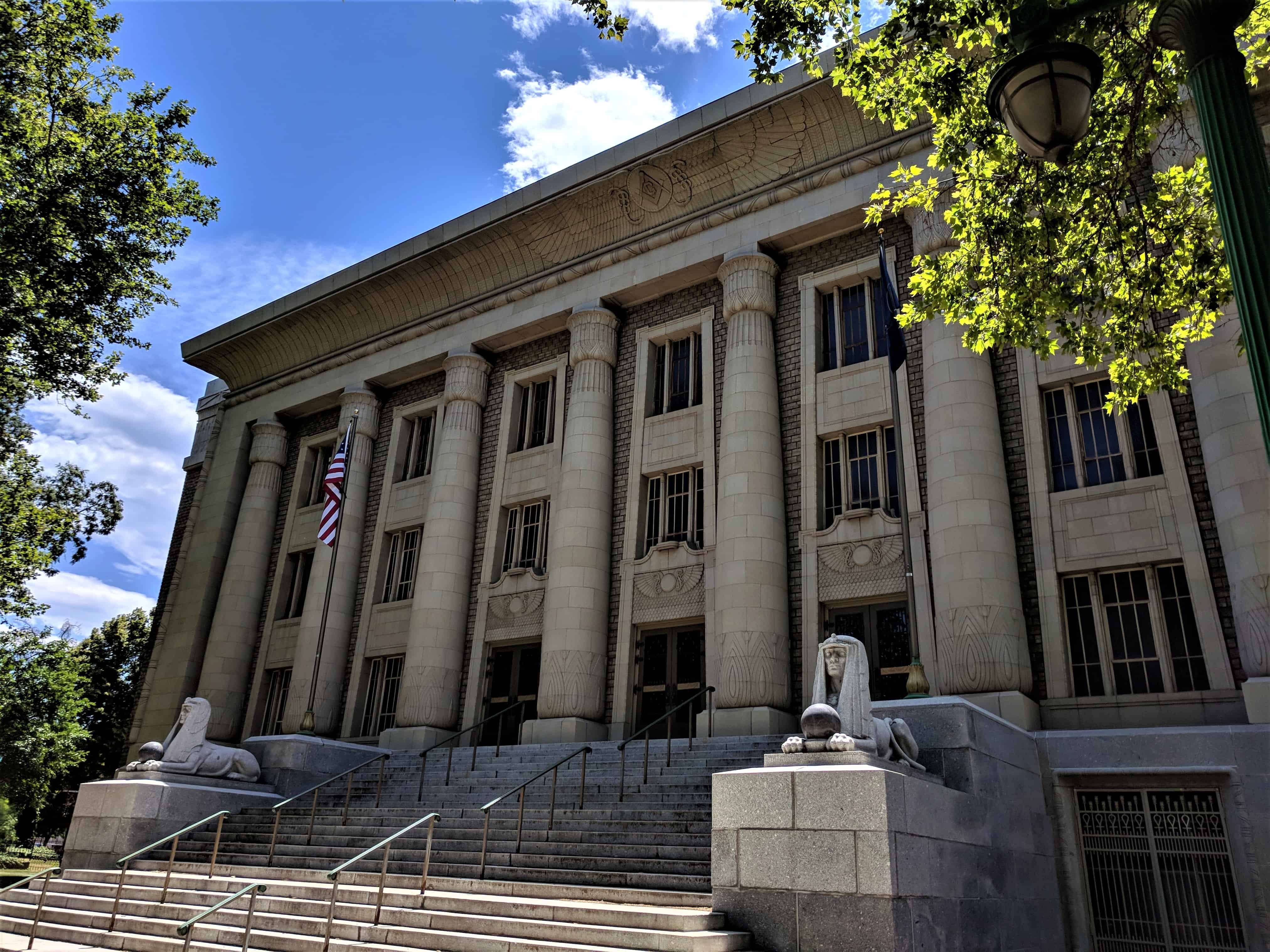
Salt Lake Masonic Temple
04SundayNov 2018
Salt Lake Masonic Temple
The Masonic Temple is the meeting place of a fraternal organization called the Masons. The word mason refers to a person who builds with brick or stone. The Masons began as a club for builders in the Middle Ages (500 – 1,500 AD). Today, the Masons sponsor many charitable activities such as Shriners Hospital, which provides free medical care for children with special needs.
The Masonic Temple is built in an architectural style called Egyptian Revival. This style became popular for a short time after further exploration of the Egyptian pyramids and the discovery of King Tutankhamen’s tomb in 1922.
The Masonic Temple, is a large Egyptian Revival Style structure built according to Masonic Law and tradition, The measurements of the building and the dimensions of the interior follow the exact number system laid out in Masonic ritual. Because of the importance of the numbers three, five and seven in Masonry, these numbers were used as a base for the design, Since the number seven was considered the perfect, number, seven and numbers divisible by seven were used in all spacing and measurement.
The columns on the building are fourteen feet apart (or multiples of seven) . The Temple is three stories high, to signify the three degrees of Masonry.

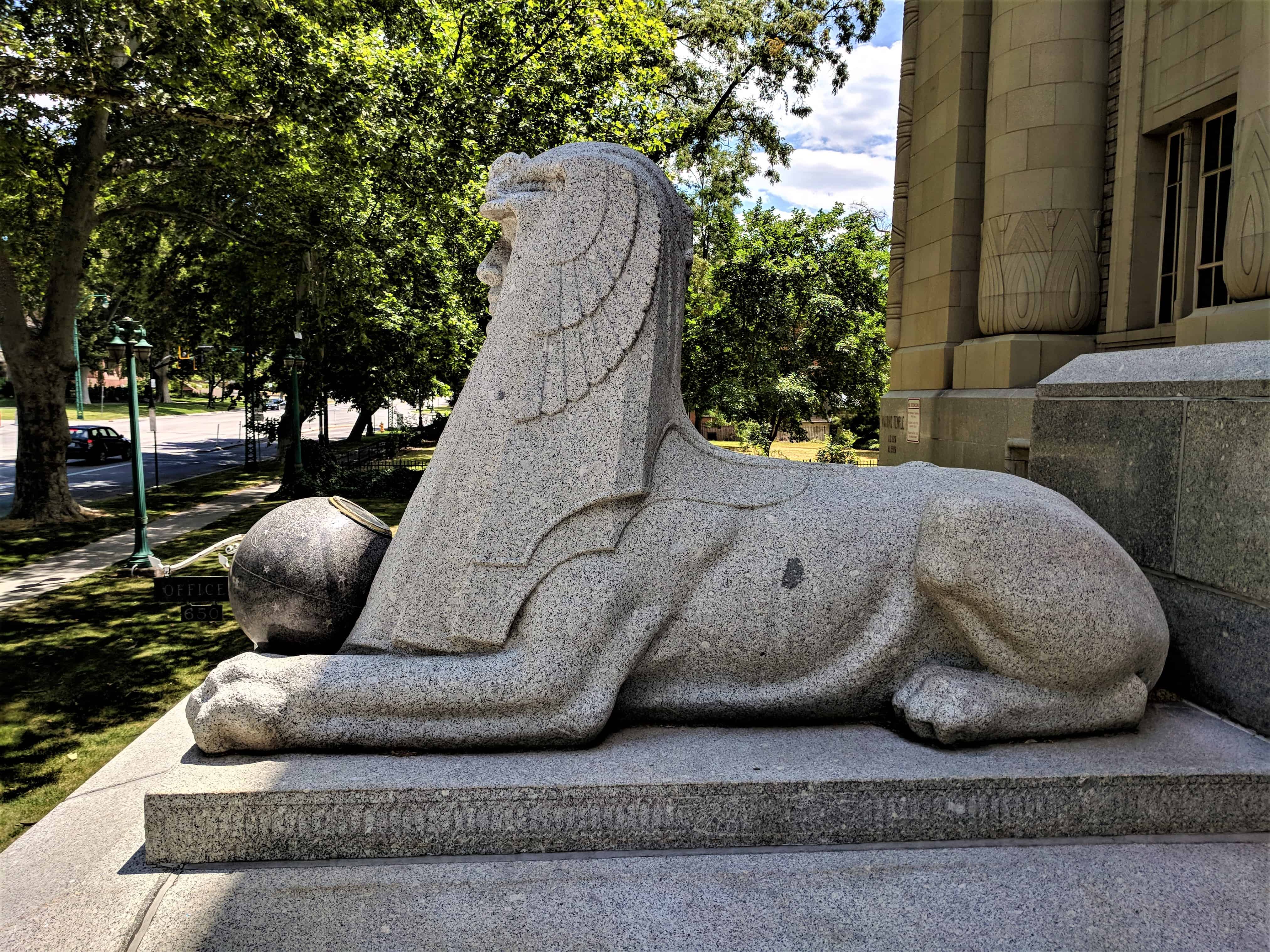
The Temple’s base is made of seven finished courses of ashlar of Utah granite. On the ground floor are non-ritualistic rooms for banquets, offices, etc, The exterior is of Egyptian Style architecture to allow for figures and inscriptions to appear and not give away their significance, There are three entrances, flanking the entrances is a pair of sphinx carved of Utah granite t The walls are of large brick laid in block fashion.

This building has always been the home of the Salt Lake Masons. The design of this Masonic Temple was derived from Masonic numerology and ritual.
This building was dedicated on November 20, 1927. The architect, Carl W, Scott, and the building committee went to other cities to view other Masonic Temples before the design for this one was chosen, The Salt Lake Masons decided to design their Temple according to Masonic ritual, which deals mainly with the work of the builders of King Solomon’s Temple, One of the major problems encountered by the architect was to build it according to Masonic law without giving away any Masonic secrets, Many plans for the building were abandoned entirely because there was no way to use them and conceal their meaning. The cornerstone was laid in an elaborate ceremony on the afternoon of November 5, 1926, with the Masons wearing’formal top hats and tails. The public is only allowed in certain lodge rooms, where people who are not masons will not understand what they see. Each of the three degrees of Masonry has its own meeting room.


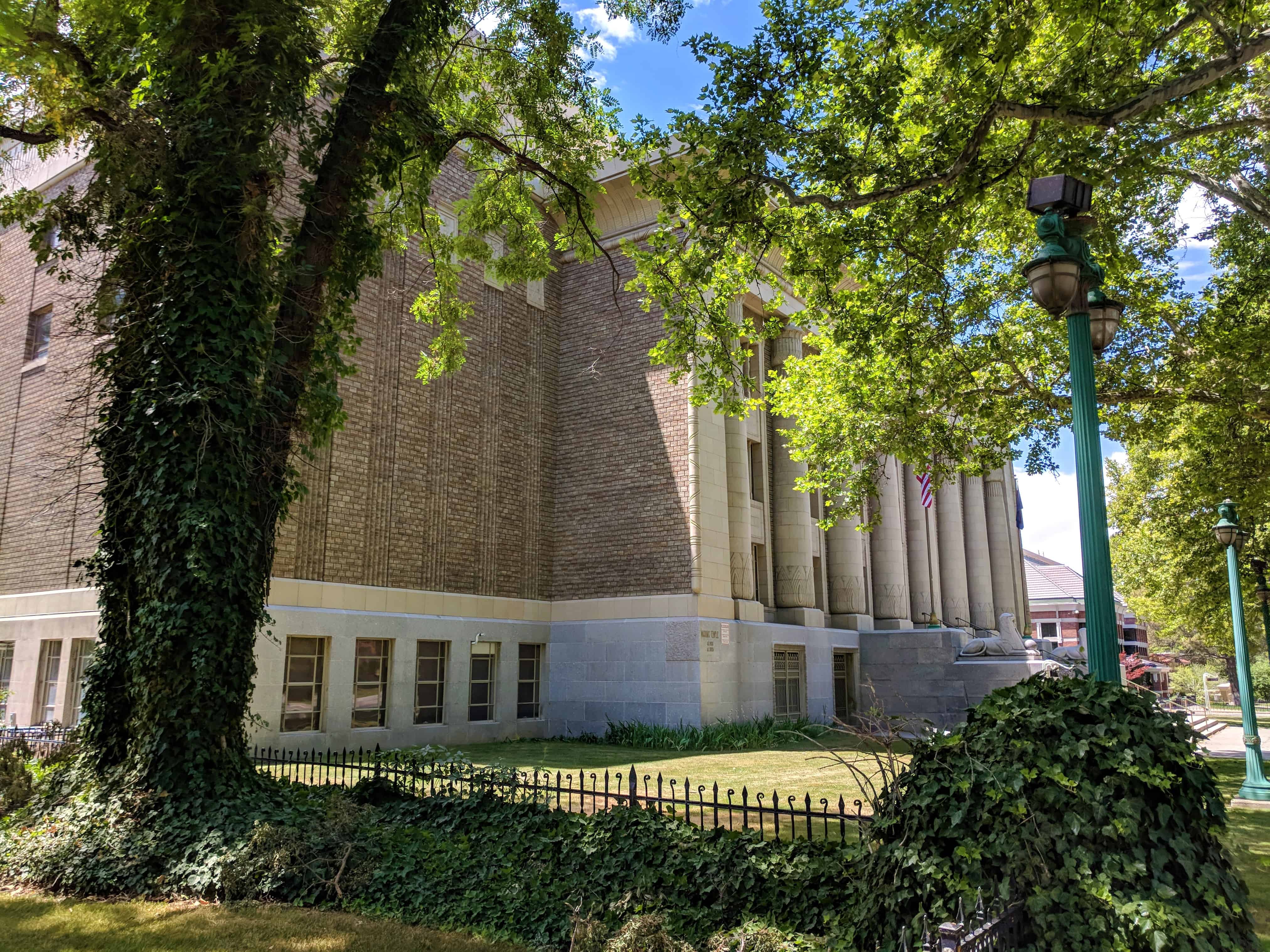


Located in the South Temple Historic District in Salt Lake City, Utah.
|
|
|
 Primeira
Anterior
3 a 17 de 32
Seguinte Primeira
Anterior
3 a 17 de 32
Seguinte Última
|
|
| |
|
|
©2024 - Gabitos - Todos os direitos reservados | |
|
|


![That's one small step..." —Neil Armstrong [1024 x 1333] : r/QuotesPorn](https://i.imgur.com/lfLGX.jpg)