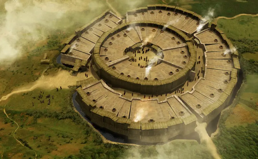
An Artists depiction of Arkaim
Located in the Southern Urals steppe, 8.2 kilometres north-to-northwest of Amurskiy are the incredible structures of Arkaim. Many archaeologists and researchers have ventured far enough to call this site the Russian Stonehenge. According to researchers, the site is generally dated to the 17th century BC. But there are several other theories that go even further dating as early as the 20th century BC. Many refer to Arkaim as “the Country of towns”, and is believed to be one of the strongest anomaly zones in Russia.
In recent years, archaeologists have found several artefacts that back up the proposed theory, that this site, located in Russia is in fact much older than mainstream archaeologists hold it for. Some even believe this archaeological site is as old as the Pyramids of Egypt, even though the exact date of the Pyramids remains an enigma.
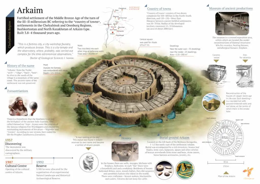
The development of Arkaim is simply amazing. The settlement was built according to a radial scheme, with the outer diameter of the circle having around one hundred and sixty meters with a moat approximately two meters deep surrounding the outer wall and the wall of Arkaim is astonishing with almost five meters wide and five meters high. Archaeologists have concluded that Arkaim was a well-planed settlement that has much more to offer regarding history and archaeology than previously thought.
According to researchers, this fortified town had a series of gates, four in total; the widest gate placed in the south-western direction while the remaining three were oriented to the cardinal directions. In addition to the walls of Arkaim, the settlement had a two-meter wide channel behind the wall connected to the outer moat. According to archaeologists, 35 houses were adjacent to the outer wall, while each of them had an exit to the main street of this ancient settlement while there were also 25 houses in the interior parts of the settlement.
The defences of this ancient settlement were very advanced, not only did the builders of Arkaim have incredible walls and an elaborate channel of water they also constructed “labyrinths” at the entrances of this settlement that were possibly fortified traps making access to the town very difficult. There are other theories that suggest that these labyrinths were not built to serve as defensive structures but rather as areligious or sacral monuments.

An infographic of Arkaim
Arkaim is clearly different in many aspects compared to other settlements of that time in history. While other cities were constructed with less elaborate defensive structures and had a more “linear” design, compared to a well designed and well-connected settlement of Arkaim, where all the buildings were interconnected and stood strong almost resembling a singular structure getting the most out of the space available for construction.
Researchers exploring Arkaim have found a number of artefacts such as pottery, metallurgical furnaces, and cattle-pens. It is believed that the ancient inhabitants of Arkaim were very skilled metallurgists.

