|
|
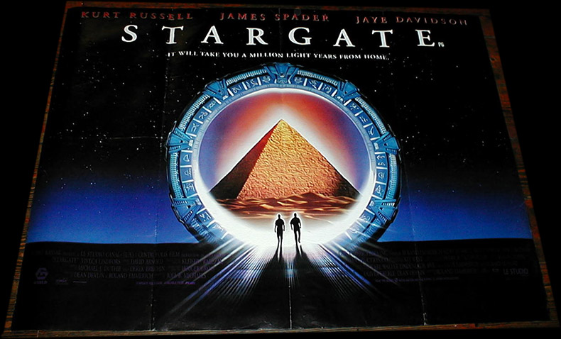
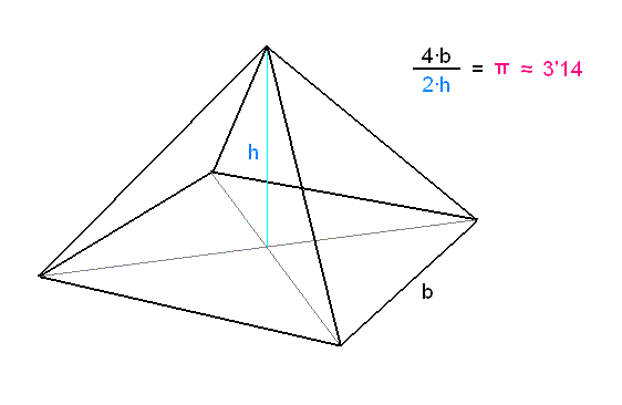
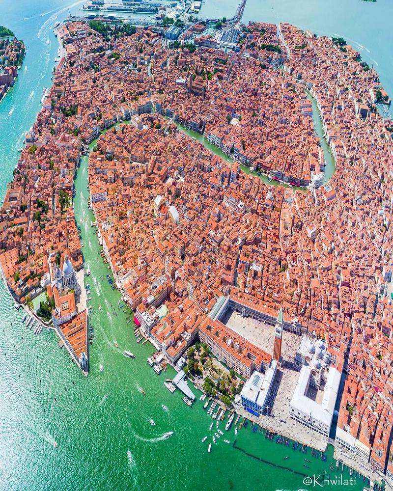
General: VENECIA="AGUA VIVA"=$=CAPITALISMO=RELATIVIDAD DE EINSTEIN=3.14=22/7
Elegir otro panel de mensajes |
|
|
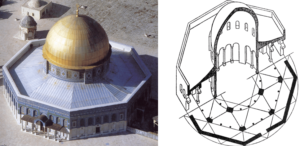
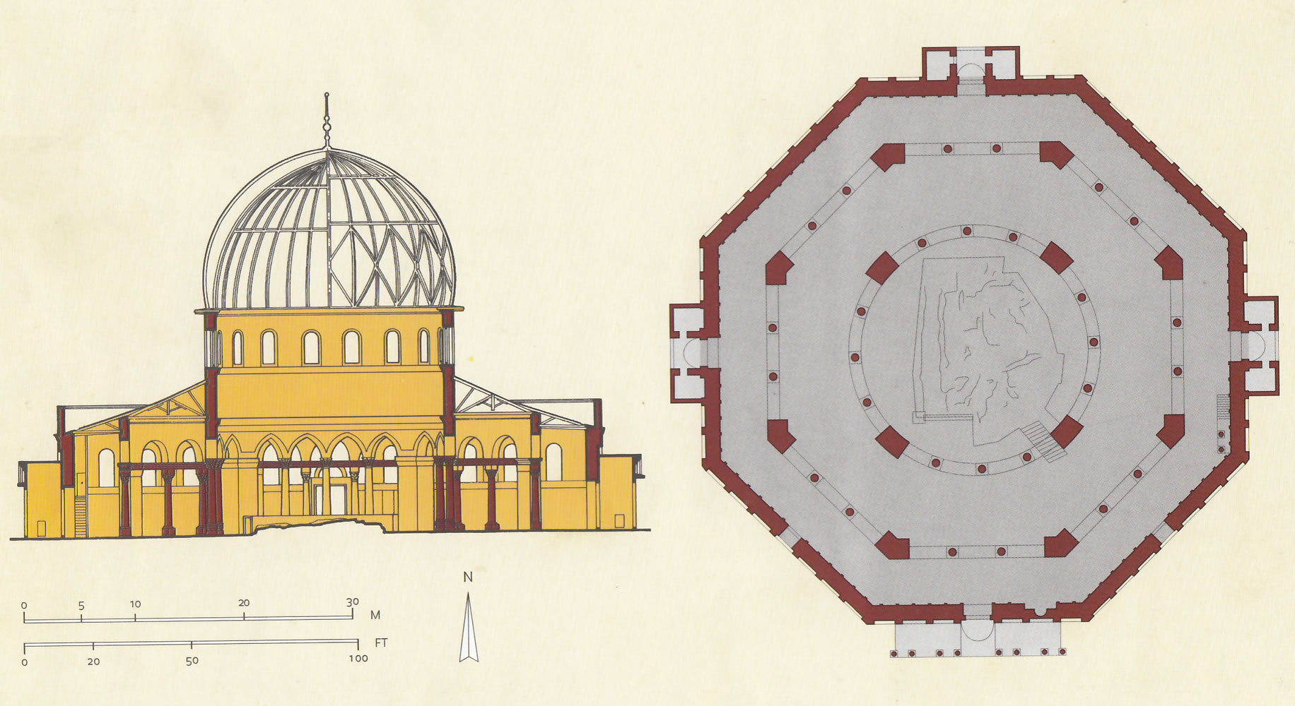
ISLA SAN GIORGIO (VENECIA)=GEORGE LEMAITRE
15 mar. 2017 - Subido por Derivando
Qué relación hay entre Albert Einstein, los ríos y el famoso número Pi? Hoy en Derivando te lo vamos a explicar ...
15 mar. 2017 - Subido por Derivando
Qué relación hay entre Albert Einstein, los ríos y el famoso número Pi? Hoy en Derivando te lo vamos a explicar ...
7 dic. 2017 - Subido por Jaume Solsona Villaplana
Einstein, los ríos y el número PI. Jaume Solsona Villaplana. Loading... Unsubscribe from Jaume Solsona ...
15 mar. 2017 - Subido por Derivando
El bloguero de YouTube Eduardo Sáenz explica uno de los descubrimientos de Albert Einstein en relación a la ...
|
|
|
|
|
DESDE EL PRIMERO DE MARZO HASTA EL TRECE DE OCTUBRE TENEMOS 227 DIAS EXACTOS.
DE TERROR
|
|
|
|
|
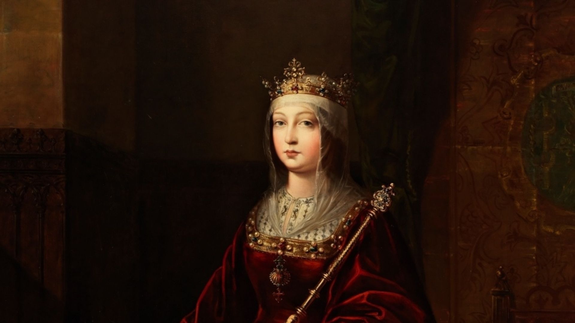
Efemérides 14 de marzo: El día que Isabel ‘la Católica’ ordenó a los judíos a convertirse
https://nuestrahistoria.es/efemerides-14-marzo-el-dia-que-isabel-la-catolica-ordeno-a-los-judios-a-convertirse/ |
|
|
|
|
ISLA SAN GIORGIO (VENECIA)=GEORGE LEMAITRE
|
|
|
|
|
ISLA SAN GIORGIO (VENECIA)=GEORGE LEMAITRE
GEMATRIA EN INGLES DE SEED=33
GEMATRIA EN INGLES DE GATE=33
SARA (CE-SAREA DE FILIPO)=PARALELO 33
|
|
|
|
|

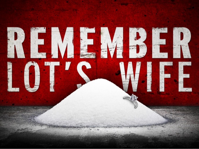
salt lake city=alchemy (salt)=dollar=$= LOT S WIFE (SODOMA AND GOMORRA)
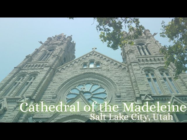
Cathedral of the Madeleine
From Wikipedia, the free encyclopedia
The Cathedral of the Madeleine is a Roman Catholic church in Salt Lake City, Utah, United States. It was completed in 1909 and currently serves as the cathedral, or mother church, of the Diocese of Salt Lake City. It is the only cathedral in the U.S. under the patronage of St. Mary Magdalene.
Description[edit]
The cathedral was built under the direction of Lawrence Scanlan, the first bishop of Salt Lake City, who dedicated it to St. Mary Magdalene.[2] It was designed by architects Carl M. Neuhausen and Bernard O. Mecklenburg. The exterior is predominantly a Neo-Romanesque design, while the inside displays more Neo-Gothic details. Construction began in 1900 and was completed in 1909. It was dedicated by James Cardinal Gibbons, Archbishop of Baltimore.
It is theorized that Bishop Scanlan chose Mary Magdalene as the patron saint of the Diocese of Salt Lake because her feast day is on July 22, two days before Pioneer Day, a celebration commemorating the arrival of the Mormon pioneers in Salt Lake Valley, so that Catholics would have something to celebrate alongside the region's dominant faith.[3]
The interior of the cathedral was created under the direction of Joseph S. Glass, the second bishop of Salt Lake. Bishop Glass enlisted John Theodore Comes, one of the preeminent architects in the country, to decorate the interior of the cathedral. His plans for the interior were largely based upon the Spanish Gothic style. The colorful murals and polychrome were added at this time, as were the ornate shrines. In 1916, Bishop Glass also changed the name of the cathedral to the French spelling after visiting her purported tomb.[2]
In the 1970s, the exterior of the building was restored, and between 1991 and 1993, the interior of the cathedral was renovated and restored under Bishop William K. Weigand. This included not only the removal of dust and dirt and restoration of the interior but also changes to the liturgical elements of the cathedral to bring them into conformity with certain widespread changes in liturgical practice that developed after the Second Vatican Council.
This included constructing a new altar, moving the cathedra, creating a separate chapel for the Blessed Sacrament, and adding an ample baptismal font. The Blessed Sacrament Chapel also contains the tomb of Bishop Scanlan.[4] Resting atop the tomb is a case containing a small relic of Saint Mary Magdalene. The cathedral in Salt Lake City and the Basilica of Saint-Maximin-la-Sainte-Baume in France are the only cathedrals in the world holding first-class relics of the saint and are named in her honor.[5] The major restoration of the interior of the cathedral was accomplished through the vision of Monsignor M. Francis Mannion.[6]
The cathedral is home to the only co-educational Catholic Choir School in the United States. The Madeleine Choir School, established in 1996, now serves over 400 students in Pre-Kindergarten through Grade Eight.[7] The Cathedral Choir has recorded several CDs and routinely tours both nationally and internationally. In addition to singing daily services at the Cathedral of the Madeleine, choristers have sung at St. Peter's Basilica (Vatican City), Notre Dame de Paris (France), and in churches across the United States of America, Spain, Italy, France, Belgium, and Germany, among other places.[8]
Composer Amédée Tremblay notably served as the church's organist from 1920 to 1925.[9]
-
-
Cathedral of the Madeleine, looking east
-
Interior of the cathedral
-
  |
|
|
|
|
Jordan River (Utah)
From Wikipedia, the free encyclopedia
The Jordan River, in the state of Utah, United States, is a river about 51 miles (82 km) long. Regulated by pumps at its headwaters at Utah Lake, it flows northward through the Salt Lake Valley and empties into the Great Salt Lake. Four of Utah's six largest cities border the river: Salt Lake City, West Valley City, West Jordan, and Sandy. More than a million people live in the Jordan Subbasin, part of the Jordan River watershed that lies within Salt Lake and Utah counties. During the Pleistocene, the area was part of Lake Bonneville.
Members of the Desert Archaic Culture were the earliest known inhabitants of the region; an archaeological site found along the river dates back 3,000 years. Mormon pioneers led by Brigham Young were the first European American settlers, arriving in July 1847 and establishing farms and settlements along the river and its tributaries. The growing population, needing water for drinking, irrigation, and industrial use in an arid climate, dug ditches and canals, built dams, and installed pumps to create a highly regulated river.
Although the Jordan was originally a cold-water fishery with 13 native species, including Bonneville cutthroat trout, it has become a warm-water fishery where the common carp is most abundant. It was heavily polluted for many years by raw sewage, agricultural runoff, and mining wastes. In the 1960s, sewage treatment removed many pollutants. In the 21st century, pollution is further limited by the Clean Water Act, and, in some cases, the Superfund program. Once the home of bighorn sheep and beaver, the contemporary river is frequented by raccoons, red foxes, and domestic pets. It is an important avian resource, as are the Great Salt Lake and Utah Lake, visited by more than 200 bird species.
Big Cottonwood, Little Cottonwood, Red Butte, Mill, Parley's, and City creeks, as well as smaller streams like Willow Creek at Draper, Utah, flow through the sub-basin. The Jordan River Parkway along the river includes natural areas, botanical gardens, golf courses, and a 40-mile (64 km) bicycle and pedestrian trail, completed in 2017.[6]
The Jordan River is Utah Lake's only outflow. It originates at the northern end of the lake between the cities of Lehi and Saratoga Springs. It then meanders north through the north end of Utah Valley for approximately 8 miles (13 km) until it passes through a gorge in the Traverse Mountains, known as the Jordan Narrows. The Utah National Guard base at Camp Williams lies on the western side of the river through much of the Jordan Narrows.[7][8] The Turner Dam, located 41.8 miles (67.3 km) from the river's mouth (or at river mile 41.8) and within the boundaries of the Jordan Narrows, is the first of two dams of the Jordan River. Turner Dam diverts the water to the right or easterly into the East Jordan Canal and to the left or westerly toward the Utah and Salt Lake Canal. Two pumping stations situated next to Turner Dam divert water to the west into the Provo Reservoir Canal, Utah Lake Distribution Canal, and Jacob-Welby Canal. The Provo Reservoir Canal runs north through Salt Lake County, Jacob-Welby runs south through Utah County. The Utah Lake Distribution Canal runs both north and south, eventually leading back into Utah Lake.[9] Outside the narrows, the river reaches the second dam, known as Joint Dam, which is 39.9 miles (64.2 km) from the river's mouth. Joint Dam diverts water to the east for the Jordan and Salt Lake City Canal and to the west for the South Jordan Canal.[10][11][12]

Map of the Salt Lake Valley
The river then flows through the middle of the Salt Lake Valley, initially moving through the city of Bluffdale and then forming the border between the cities of Riverton and Draper.[7] The river then enters the city of South Jordan where it merges with Midas Creek from the west. Upon leaving South Jordan, the river forms the border between the cities of West Jordan on the west and Sandy and Midvale on the east. From the west, Bingham Creek enters West Jordan. Dry Creek, an eastern tributary, combines with the main river in Sandy. The river then forms the border between the cities of Taylorsville and West Valley City on the west and Murray and South Salt Lake on the east. The river flows underneath Interstate 215 in Murray. Little and Big Cottonwood Creeks enter from the east in Murray, 21.7 miles (34.9 km) and 20.6 miles (33.2 km) from the mouth respectively. Mill Creek enters on the east in South Salt Lake, 17.3 miles (27.8 km) from the mouth. The river runs through the middle of Salt Lake City, where the river travels underneath Interstate 80 a mile west of downtown Salt Lake City and again underneath Interstate 215 in the northern portion of Salt Lake City. Interstate 15 parallels the river's eastern flank throughout Salt Lake County. At 16 miles (26 km) from the mouth, the river enters the Surplus Canal channel. The Jordan River physically diverts from the Surplus Canal through four gates and heads north with the Surplus Canal heading northwest. Parley's, Emigration, and Red Butte Creeks converge from the east through an underground pipe, 14.2 miles (22.9 km) from the mouth.[7] City Creek also enters via an underground pipe, 11.5 miles (18.5 km) from the river's mouth. The length of the river and the elevation of its mouth varies year to year depending on the fluctuations of the Great Salt Lake caused by weather conditions. The lake has an average elevation of 4,200 feet (1,300 m) which can deviate by 10 feet (3.0 m).[3] The Jordan River then continues for 9 to 12 miles (14 to 19 km) with Salt Lake County on the west and North Salt Lake and Davis County on the east until it empties into the Great Salt Lake.[7][8][11]
Discharge[edit]
The United States Geological Survey maintains a stream gauge in Salt Lake City that shows annual runoff from the period 1980–2003 is just over 150,000 acre-feet (190,000,000 m3) per year or 100 percent of the total 800,000 acre-feet (990,000,000 m3) of water entering the Jordan River from all sources. The Surplus Canal carries almost 60 percent of the water into the Great Salt Lake, with various irrigation canals responsible for the rest. The amount of water entering the Jordan River from Utah Lake is just over 400,000 acre-feet (490,000,000 m3) per year. Inflow from the 11 largest streams feeding the Jordan River, sewage treatment plants, and groundwater each account for approximately 15 percent of water entering the river.[13]
Watershed[edit]

Map of the entire Jordan River Basin
|
|
|
 Primer
Anterior
108 a 122 de 137
Siguiente Primer
Anterior
108 a 122 de 137
Siguiente Último
|
|
| |
|
|
©2024 - Gabitos - Todos los derechos reservados | |
|
|


![59 - Curso de Relatividad General [Ecuaciones de Campo & Constante Cosmológica] - YouTube](https://i.ytimg.com/vi/HI3m80zLo24/maxresdefault.jpg)


![Descubrimiento de la Estructura del ADN [Infografía]](https://3.bp.blogspot.com/-5btVztv_otA/XqTJX6FapKI/AAAAAAAAARs/DZFU_dHlelYXgLoFsmVLOZf2fEKMf73iQCPcBGAYYCw/s1600/descubrimiento-estructura-adn.png)