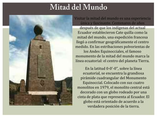
SANTA ELENA ES LA MADRE DE CONSTANTINO ¿CASUALIDAD O CAUSALIDAD? (NEXO 911)
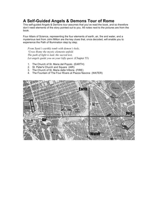
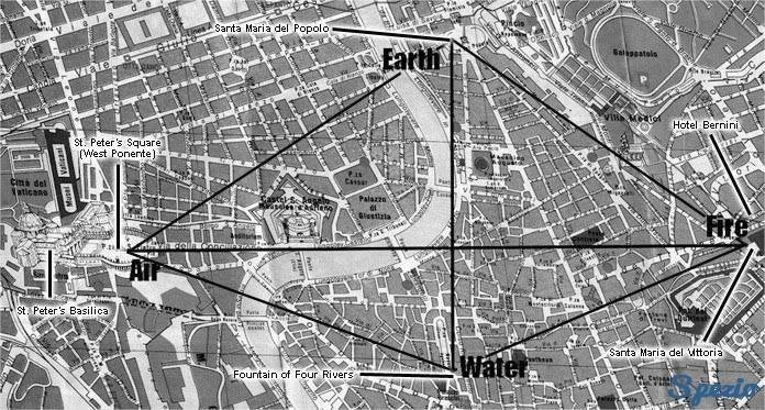
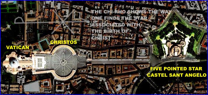
TODOS LOS CAMINOS CONDUCEN A ROMA.
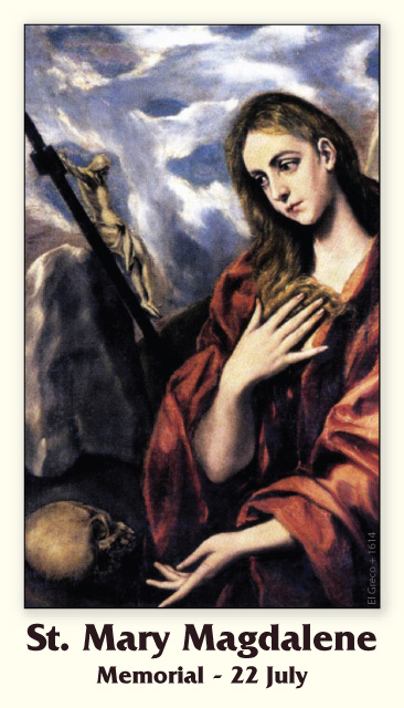
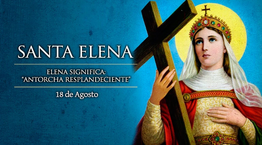
Santa Elena, Madre de Constantino – 18 de Agosto
Santa Elena, madre del emperador Constantino, tuvo un interés singular en ayudar a los pobres y acudía a la iglesia piadosamente confundida entre los fieles.
En un mesón propiedad de sus padres en Daprasano (Nicomedia) nació pobre en el seno de una familia pagana. Allí pudo, en su juventud, contemplar los efectos de las persecuciones mandadas desde Roma: vió a los cristianos que eran tomados presos y metidos en las cárceles de donde salían para ser atormentados cruelmente, quemados vivos o arrojados a las fieras. Nunca lo entendió; ella conocía a algunos de ellos y alguna de las cristianas muertas fueron de sus amigas ¿qué mal hacían para merecer la muerte? A su entender, sólo podía asegurar que eran personas excelentes.
San Ambrosio, que vivió en época inmediatamente posterior, la describe como una mujer privilegiada en dones naturales y en nobleza de corazón. Y así debía ser cuando se enamoró de ella Constancio, el que lleva el sobrenombre de Cloro por el color pálido de su tez, general valeroso y prefecto del pretorio durante Maximiano. Tenía Elena 23 años al contraer matrimonio. En Naïsus (Dardania) les nació, el 27 de febrero del 274, el hijo que llegaría a ser César de Maximiano como Galerio lo fue de Diocleciano.
Pero no todo fueron alegrías. Elena fue repudiada por motivos políticos en el 292 para poder casarse Constancio con la hijastra de Maximiano y llegar a establecer así el parentesco imprescindible entre los miembros de la tetrarquía. Le costó mucho saberse pospuesta al deseo de poder de su marido, pero esto lo aceptó mejor que el hecho de verse separada de su hijo Constantino que pasó a educarse en el palacio junto a su padre y donde se reveló como un fantástico organizador y estratega.
Muerto Constancio Cloro en el 306, Constantino decide llevarse a su madre a vivir con él a la corte de Tréveris. En esta época aún no hay certeza histórica de que su madre fuera cristiana. Sí, cuando -por testimonio de Eusebio de Cesarea- aparezca sobre el sol el signo de la cruz con motivo de la batalla de Saxa Rubra y la leyenda "con este signo vencerás" que dio el triunfo a Constantino y lo hizo único Emperador de Roma, en el 312.
Aunque el emperador retrasará su bautismo hasta la misma muerte, es complaciente con la condición de cristiana que tiene su madre que daba sonados ejemplos de humildad y caridad. Incluso parece descubrirse la influencia materna tras el Edicto de Milán que prohibía la persecución de los cristianos y los edictos posteriores que terminan vetando el culto a los dioses lares. Agasaja a su madre haciéndola Augusta, acuña monedas con su efigie y le facilita levantar iglesias.
En el 326 Elena está con su hijo en Bizancio, a orillas del Bósforo. Aunque se aproxima ya a los setenta años alienta en su espíritu un deseo altamente repensado y nunca confesado, pero que cada día crece y toma fuerza en su alma; anhela ver, tocar, palpar y venerar el sagrado leño donde Cristo entregó su vida por todos los hombres. Organiza un viaje a los Santos Lugares en cuyo relato se mezclan todos los elementos imaginables pertenecientes al mundo de la fábula por tratarse del desplazamiento de la primera dama del Imperio a los humildes a lejanos lugares donde nació, vivió, sufrió y resucitó el Redentor. Pero aparte de todo lo que de fantástico pueda haber en los relatos, fuentes suficientemente atendibles como Crisóstomo, Ambrosio, Paulino de Nola y Sulpicio Severo refieren que se dedicó a una afanosa búsqueda de la Santa Cruz con resultados negativos entre los cristianos que no saben dar respuesta satisfactoria a sus pesquisas. Sintiéndose frustrada, pasa a indagar entre los judíos hasta encontrar a un tal Judas que le revela el secreto rigurosamente guardado entre una facción de ellos que, para privar a los cristianos de su símbolo, decidieron arrojar a un pozo las tres cruces del Calvario y lo cegaron luego con tierra.
Las excavaciones resultaron con éxito. Aparecieron las tres cruces con gran júbilo de Elena. Sacadas a la luz, sólo resta ahora la grave dificultad de llegar a determinar aquella en la que estuvo clavado Jesús. Relatan que el obispo Demetrio tuvo la idea de organizar una procesión solemne, con toda la veneración que el asunto requería, rezando plegarias y cantando salmodias, para poner sobre las cruces descubiertas el cuerpo de una cristiana moribunda por si Dios quisiera mostrar la Vera Cruz. El milagro se produjo al ser colocada en sus parihuelas sobre la tercera de las cruces la pobre enferma que recuperó milagrosamente la salud.
Tres partes mandó hacer Elena de la Cruz. Una se trasladó a Constantinopla, otra quedó en Jerusalén y la tercera llegó a Roma donde se conserva y venera en la iglesia de la Santa Cruz de Jerusalén.
No han faltado autores que atribuyan a la fábula el hecho de la invención por Elena basándose principalmente en que no hay noticia expresa de tamaño acontecimiento hasta un siglo después. Ciertamente es así, pero lo resuelven otros estudiosos afirmando que la fuente histórica que relata los acontecimientos es el historiador contemporáneo Eusebio de Cesarea al que en su Vita Constantini sólo le interesan los acontecimientos realizados por Constantino, bien porque sigue los cánones de la historia contemporánea, o quizá porque sólo le interesa adular a su anfitrión.
Murió Elena sin que sepamos el sitio ni la fecha. Su hijo Constantino dispuso trasladar sus restos con gran solemnidad a la Ciudad Eterna y parte de ellos se conservan en la iglesia Ara Coeli, dedicada a Santa Elena, la mujer que dejó testimonio tangible y visible en unos maderos del paso salvador por la tierra de Jesús, el Hijo de Dios encarnado.
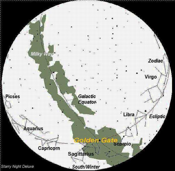
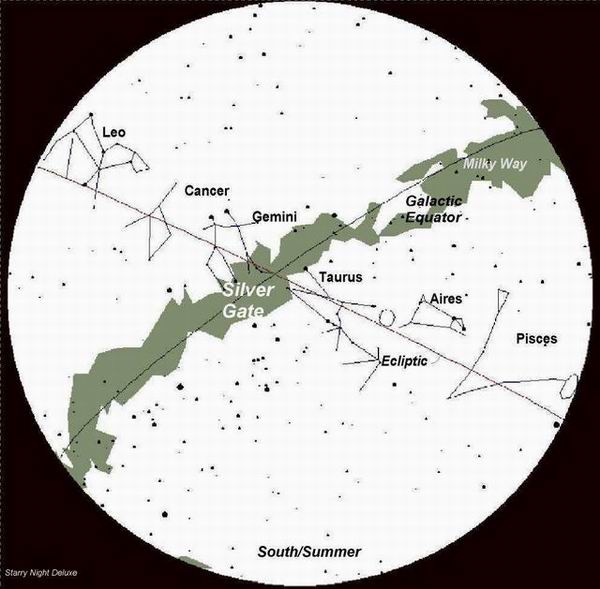
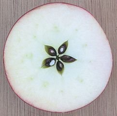
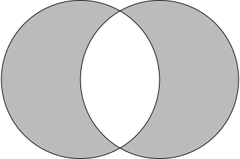
La vesica piscis (vejiga de pez en latín) es un símbolo hecho con dos círculos del mismo radio que se intersecan de manera que el centro de cada círculo está en la circunferencia del otro. Esta forma se denomina también mandorla (que significa "almendra" en italiano).
Era un símbolo conocido en las antiguas civilizaciones de Mesopotamia, África y Asia.
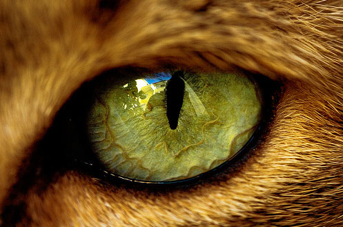
CATOLICO/CAT-OLICO/CAT-EDRAL/CAT/GATO-EL OJO DEL GATO TIENE LA MISMA FORMA QUE LA DEL SEXO FEMENINO "VESCICA PISCIS"
The Jordan River, in the state of Utah, United States, is a river about 51 miles (82 km) long. Regulated by pumps at its headwaters at Utah Lake, it flows northward through the Salt Lake Valley and empties into the Great Salt Lake. Four of Utah's six largest cities border the river: Salt Lake City, West Valley City, West Jordan, and Sandy. More than a million people live in the Jordan Subbasin, part of the Jordan River watershed that lies within Salt Lake and Utah counties. During the Pleistocene, the area was part of Lake Bonneville.
Members of the Desert Archaic Culture were the earliest known inhabitants of the region; an archaeological site found along the river dates back 3,000 years. Mormon pioneers led by Brigham Young were the first European American settlers, arriving in July 1847 and establishing farms and settlements along the river and its tributaries. The growing population, needing water for drinking, irrigation, and industrial use in an arid climate, dug ditches and canals, built dams, and installed pumps to create a highly regulated river.
Although the Jordan was originally a cold-water fishery with 13 native species, including Bonneville cutthroat trout, it has become a warm-water fishery where the common carp is most abundant. It was heavily polluted for many years by raw sewage, agricultural runoff, and mining wastes. In the 1960s, sewage treatment removed many pollutants. In the 21st century, pollution is further limited by the Clean Water Act, and, in some cases, the Superfund program. Once the home of bighorn sheep and beaver, the contemporary river is frequented by raccoons, red foxes, and domestic pets. It is an important avian resource, as are the Great Salt Lake and Utah Lake, visited by more than 200 bird species.
The Jordan River is Utah Lake's only outflow. It originates at the northern end of the lake between the cities of Lehi and Saratoga Springs. It then meanders north through the north end of Utah Valley for approximately 8 miles (13 km) until it passes through a gorge in the Traverse Mountains, known as the Jordan Narrows. The Utah National Guard base at Camp Williams lies on the western side of the river through much of the Jordan Narrows.[7][8] The Turner Dam, located 41.8 miles (67.3 km) from the river's mouth (or at river mile 41.8) and within the boundaries of the Jordan Narrows, is the first of two dams of the Jordan River. Turner Dam diverts the water to the right or easterly into the East Jordan Canal and to the left or westerly toward the Utah and Salt Lake Canal. Two pumping stations situated next to Turner Dam divert water to the west into the Provo Reservoir Canal, Utah Lake Distribution Canal, and Jacob-Welby Canal. The Provo Reservoir Canal runs north through Salt Lake County, Jacob-Welby runs south through Utah County. The Utah Lake Distribution Canal runs both north and south, eventually leading back into Utah Lake.[9] Outside the narrows, the river reaches the second dam, known as Joint Dam, which is 39.9 miles (64.2 km) from the river's mouth. Joint Dam diverts water to the east for the Jordan and Salt Lake City Canal and to the west for the South Jordan Canal.[10][11][12]
Map of the Salt Lake Valley
The river then flows through the middle of the Salt Lake Valley, initially moving through the city of Bluffdale and then forming the border between the cities of Riverton and Draper.[7] The river then enters the city of South Jordan where it merges with Midas Creek from the west. Upon leaving South Jordan, the river forms the border between the cities of West Jordan on the west and Sandy and Midvale on the east. From the west, Bingham Creek enters West Jordan. Dry Creek, an eastern tributary, combines with the main river in Sandy. The river then forms the border between the cities of Taylorsville and West Valley City on the west and Murray and South Salt Lake on the east. The river flows underneath Interstate 215 in Murray. Little and Big Cottonwood Creeks enter from the east in Murray, 21.7 miles (34.9 km) and 20.6 miles (33.2 km) from the mouth respectively. Mill Creek enters on the east in South Salt Lake, 17.3 miles (27.8 km) from the mouth. The river runs through the middle of Salt Lake City, where the river travels underneath Interstate 80 a mile west of downtown Salt Lake City and again underneath Interstate 215 in the northern portion of Salt Lake City. Interstate 15 parallels the river's eastern flank throughout Salt Lake County. At 16 miles (26 km) from the mouth, the river enters the Surplus Canal channel. The Jordan River physically diverts from the Surplus Canal through four gates and heads north with the Surplus Canal heading northwest. Parley's, Emigration, and Red Butte Creeks converge from the east through an underground pipe, 14.2 miles (22.9 km) from the mouth.[7] City Creek also enters via an underground pipe, 11.5 miles (18.5 km) from the river's mouth. The length of the river and the elevation of its mouth varies year to year depending on the fluctuations of the Great Salt Lake caused by weather conditions. The lake has an average elevation of 4,200 feet (1,300 m) which can deviate by 10 feet (3.0 m).[3] The Jordan River then continues for 9 to 12 miles (14 to 19 km) with Salt Lake County on the west and North Salt Lake and Davis County on the east until it empties into the Great Salt Lake.[7][8][11]
The United States Geological Survey maintains a stream gauge in Salt Lake City that shows annual runoff from the period 1980–2003 is just over 150,000 acre-feet (190,000,000 m3) per year or 100 percent of the total 800,000 acre-feet (990,000,000 m3) of water entering the Jordan River from all sources. The Surplus Canal carries almost 60 percent of the water into the Great Salt Lake, with various irrigation canals responsible for the rest. The amount of water entering the Jordan River from Utah Lake is just over 400,000 acre-feet (490,000,000 m3) per year. Inflow from the 11 largest streams feeding the Jordan River, sewage treatment plants, and groundwater each account for approximately 15 percent of water entering the river.[13]
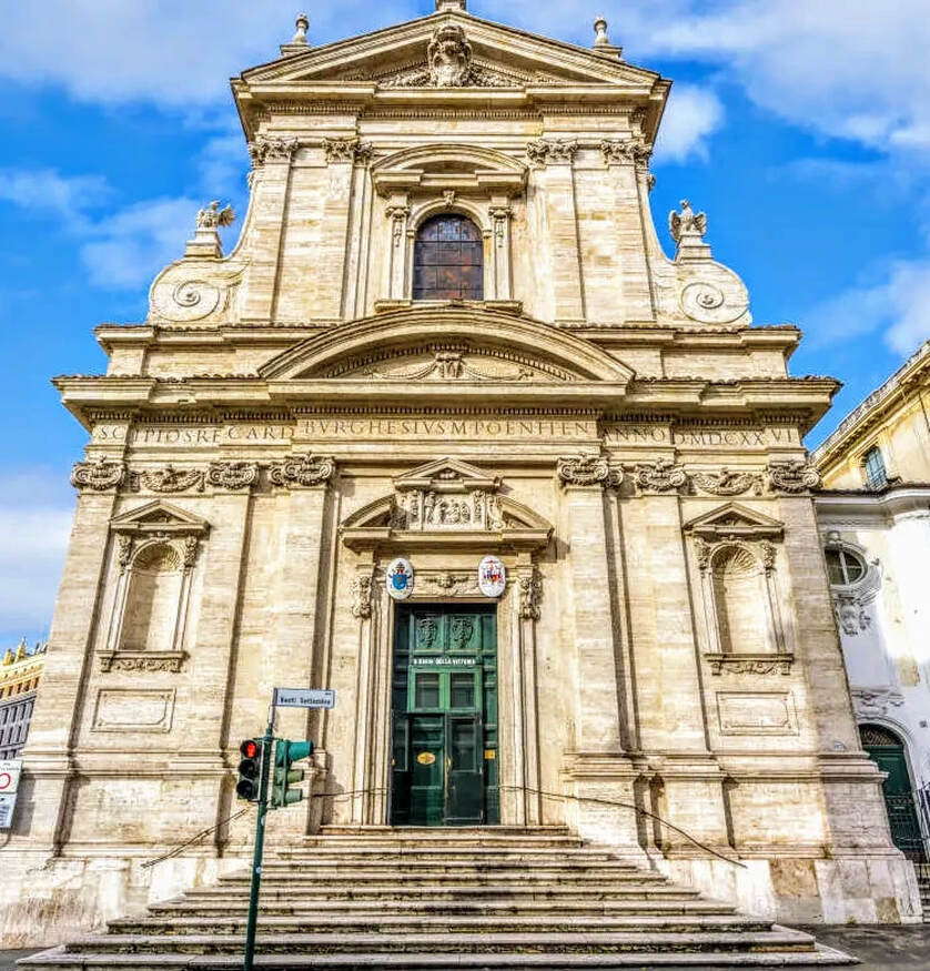
Los Carmelitas descalzos obtuvieron un Breve apostólico de Paulo V para edificar conventos de su Orden en cualquier parte de la Cristiandad; fue este el primero que fundaron en la última parte del Monte Quirinal el año de 1606.
La iglesia se fundó en 1605 como una capilla dedicada a san Pablo para los carmelitas descalzos. La propia orden dotó de fondos a la obra del edificio hasta el descubrimiento en las excavaciones de la escultura conocida como el Hermafrodita Borghese. Scipione Borghese se apropió de ella, pero a cambio, y quizá para compensar su pérdida de influencia debido a la muerte de su tío y patrón, financió el resto de la obra de la fachada y prestó a la orden a su arquitecto, Giovanni Battista Soria. Estas concesiones, sin embargo, sólo se llevaron a efecto en 1624, aunque la obra se acabó dos años más tarde.
Después de la victoria católica en la batalla de la Montaña Blanca en 1620, que hizo retroceder la Reforma en Bohemia, la iglesia fue consagrada de nuevo a la Virgen María. Una imagen maltrecha había sido recuperada del ámbito de aquella batalla por Fray Domingo de Jesús María, de dicha Orden, de las ruinas de la casa de campo de un noble cristiano bohemio, a la cual se le atribuyó la victoria, llamándola Santa María de la Victoria. La imagen fue llevada a Roma por Fray Domingo, depositándose en Santa María la Mayor en presencia de Gregorio XV.
El nombre de Santa María de la Victoria, se dio ulteriormente, en conmemoración por haber reconquistado el emperador Fernando I la ciudad de Praga en 1671. Estandartes turcos capturados en el Sitio de Viena de 1683 cuelgan en la iglesia, como parte de este tema victorioso.
La iglesia es la única estructura diseñada y completada por el arquitecto del Barroco temprano, Carlo Maderno, aunque el interior padeció un fuego en 1833 y requirió una restauración. Su fachada, sin embargo, fue erigida por Soria en vida de Maderno (1624-1626), mostrando la inconfundible influencia de la cercana Santa Susanna de Maderno.
Su interior tiene una sola nave, amplia, bajo una bóveda segmentada baja, con tres capillas laterales interconectadas detrás de arcos separados por colosales pilastras corintias con capiteles dorados que apoyan un rico entablamento. Revestimientos de mármol que contrastan entre sí están enriquecidos con ángeles y putti de estuco blanco y dorado en bulto redondo. El interior fue enriquecido progresivamente después de la muerte de Maderno; su bóveda fue pintada al fresco en 1663 con temas triunfales dentro de compartimentos con marcos ficticios: La Virgen María triunfa sobre la Herejía y Caída de los ángeles rebeldes ejecutados por Giovanni Domenico Cerrini.
Sin duda, parte de la fama de este templo se debe a albergar una de las obras maestras del Barroco, la capilla Cornaro, espectacular y teatral espacio presidido por el grupo escultórico que representa el Éxtasis de Santa Teresa, de Gian Lorenzo Bernini, quizá la obra más conocida de este autor en el campo de la escultura. En la capilla situada frente a esta, dedicada a San José, se encuentra un grupo escultórico que representa el tema del Sueño de San José, obra del escultor Domenico Guidi, que se inspira en la obra de Bernini delante de la cual se halla.1
The Jordan River, in the state of Utah, United States, is a river about 51 miles (82 km) long. Regulated by pumps at its headwaters at Utah Lake, it flows northward through the Salt Lake Valley and empties into the Great Salt Lake. Four of Utah's six largest cities border the river: Salt Lake City, West Valley City, West Jordan, and Sandy. More than a million people live in the Jordan Subbasin, part of the Jordan River watershed that lies within Salt Lake and Utah counties. During the Pleistocene, the area was part of Lake Bonneville.
Members of the Desert Archaic Culture were the earliest known inhabitants of the region; an archaeological site found along the river dates back 3,000 years. Mormon pioneers led by Brigham Young were the first European American settlers, arriving in July 1847 and establishing farms and settlements along the river and its tributaries. The growing population, needing water for drinking, irrigation, and industrial use in an arid climate, dug ditches and canals, built dams, and installed pumps to create a highly regulated river.
Although the Jordan was originally a cold-water fishery with 13 native species, including Bonneville cutthroat trout, it has become a warm-water fishery where the common carp is most abundant. It was heavily polluted for many years by raw sewage, agricultural runoff, and mining wastes. In the 1960s, sewage treatment removed many pollutants. In the 21st century, pollution is further limited by the Clean Water Act, and, in some cases, the Superfund program. Once the home of bighorn sheep and beaver, the contemporary river is frequented by raccoons, red foxes, and domestic pets. It is an important avian resource, as are the Great Salt Lake and Utah Lake, visited by more than 200 bird species.
The Jordan River is Utah Lake's only outflow. It originates at the northern end of the lake between the cities of Lehi and Saratoga Springs. It then meanders north through the north end of Utah Valley for approximately 8 miles (13 km) until it passes through a gorge in the Traverse Mountains, known as the Jordan Narrows. The Utah National Guard base at Camp Williams lies on the western side of the river through much of the Jordan Narrows.[7][8] The Turner Dam, located 41.8 miles (67.3 km) from the river's mouth (or at river mile 41.8) and within the boundaries of the Jordan Narrows, is the first of two dams of the Jordan River. Turner Dam diverts the water to the right or easterly into the East Jordan Canal and to the left or westerly toward the Utah and Salt Lake Canal. Two pumping stations situated next to Turner Dam divert water to the west into the Provo Reservoir Canal, Utah Lake Distribution Canal, and Jacob-Welby Canal. The Provo Reservoir Canal runs north through Salt Lake County, Jacob-Welby runs south through Utah County. The Utah Lake Distribution Canal runs both north and south, eventually leading back into Utah Lake.[9] Outside the narrows, the river reaches the second dam, known as Joint Dam, which is 39.9 miles (64.2 km) from the river's mouth. Joint Dam diverts water to the east for the Jordan and Salt Lake City Canal and to the west for the South Jordan Canal.[10][11][12]
Map of the Salt Lake Valley
The river then flows through the middle of the Salt Lake Valley, initially moving through the city of Bluffdale and then forming the border between the cities of Riverton and Draper.[7] The river then enters the city of South Jordan where it merges with Midas Creek from the west. Upon leaving South Jordan, the river forms the border between the cities of West Jordan on the west and Sandy and Midvale on the east. From the west, Bingham Creek enters West Jordan. Dry Creek, an eastern tributary, combines with the main river in Sandy. The river then forms the border between the cities of Taylorsville and West Valley City on the west and Murray and South Salt Lake on the east. The river flows underneath Interstate 215 in Murray. Little and Big Cottonwood Creeks enter from the east in Murray, 21.7 miles (34.9 km) and 20.6 miles (33.2 km) from the mouth respectively. Mill Creek enters on the east in South Salt Lake, 17.3 miles (27.8 km) from the mouth. The river runs through the middle of Salt Lake City, where the river travels underneath Interstate 80 a mile west of downtown Salt Lake City and again underneath Interstate 215 in the northern portion of Salt Lake City. Interstate 15 parallels the river's eastern flank throughout Salt Lake County. At 16 miles (26 km) from the mouth, the river enters the Surplus Canal channel. The Jordan River physically diverts from the Surplus Canal through four gates and heads north with the Surplus Canal heading northwest. Parley's, Emigration, and Red Butte Creeks converge from the east through an underground pipe, 14.2 miles (22.9 km) from the mouth.[7] City Creek also enters via an underground pipe, 11.5 miles (18.5 km) from the river's mouth. The length of the river and the elevation of its mouth varies year to year depending on the fluctuations of the Great Salt Lake caused by weather conditions. The lake has an average elevation of 4,200 feet (1,300 m) which can deviate by 10 feet (3.0 m).[3] The Jordan River then continues for 9 to 12 miles (14 to 19 km) with Salt Lake County on the west and North Salt Lake and Davis County on the east until it empties into the Great Salt Lake.[7][8][11]
The United States Geological Survey maintains a stream gauge in Salt Lake City that shows annual runoff from the period 1980–2003 is just over 150,000 acre-feet (190,000,000 m3) per year or 100 percent of the total 800,000 acre-feet (990,000,000 m3) of water entering the Jordan River from all sources. The Surplus Canal carries almost 60 percent of the water into the Great Salt Lake, with various irrigation canals responsible for the rest. The amount of water entering the Jordan River from Utah Lake is just over 400,000 acre-feet (490,000,000 m3) per year. Inflow from the 11 largest streams feeding the Jordan River, sewage treatment plants, and groundwater each account for approximately 15 percent of water entering the river.[13]


![August 6 THE TRANSFIGURATION OF OUR LORD [Feast] MASS PRAYERS AND READINGS. - Catholics Striving For Holiness](https://i2.wp.com/catholicsstrivingforholiness.org/wp-content/uploads/2019/08/AUG.-6-TRANSFIGURATION.jpg)


![La puerta del sol.docx - [PDF Document]](https://reader008.fdocuments.ec/reader008/html5/092105/614906eab9641/614906ec9774a.png)