|
|
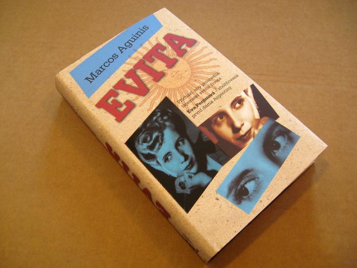
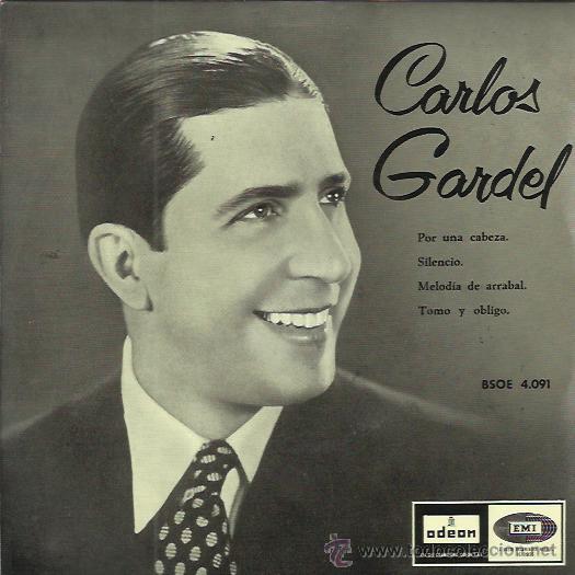
General: CARLOS GARDEL, MURIO, EL 24 DE JUNIO, EN COLOMBIA (DIA DE JUAN EL BAUTISTA)
Elegir otro panel de mensajes |
|
|
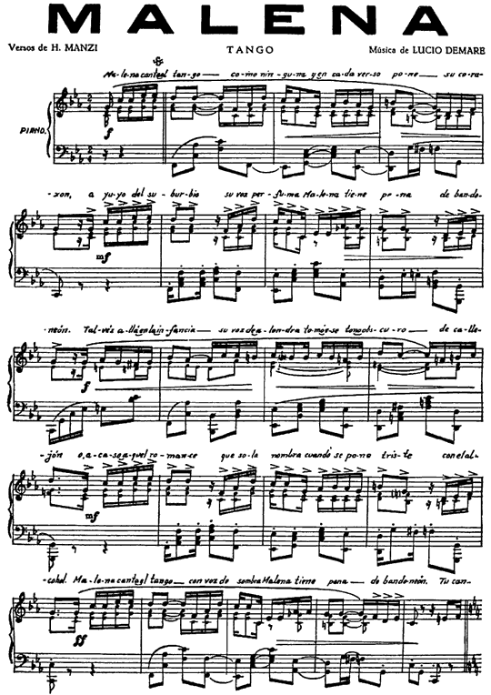
Canciones y información general
|
|
|
|
|
|
|
|
| Hechos 12:12: |
Y habiendo considerado esto, llegó a casa de María la madre de Juan, el que tenía por sobrenombre Marcos, donde muchos estaban reunidos orando. |
| Hechos 12:12: |
Y habiendo considerado esto, llegó a casa de María la madre de Juan, el que tenía por sobrenombre Marcos, donde muchos estaban reunidos orando. |
| Hechos 12:10: |
Habiendo pasado la primera y la segunda guardia, llegaron a la puerta de hierro que daba a la ciudad, la cual se les abrió por sí misma; y salidos, pasaron una calle, y luego el ángel se apartó de él. |
| Apocalipsis 2:27: |
y las regirá con vara de hierro, y serán quebradas como vaso de alfarero; como yo también la he recibido de mi Padre; |
|
|
|
|
|
|
|
|
| Mateo 11:14: |
Y si queréis recibirlo, él es aquel Elías que había de venir. |
| Mateo 16:14: |
Ellos dijeron: Unos, Juan el Bautista; otros, Elías; y otros, Jeremías, o alguno de los profetas. |
| Mateo 17:3: |
Y he aquí les aparecieron Moisés y Elías, hablando con él. |
| Mateo 17:4: |
Entonces Pedro dijo a Jesús: Señor, bueno es para nosotros que estemos aquí; si quieres, hagamos aquí tres enramadas: una para ti, otra para Moisés, y otra para Elías. |
| Mateo 17:10: |
Entonces sus discípulos le preguntaron, diciendo: ¿Por qué, pues, dicen los escribas que es necesario que Elías venga primero? |
| Mateo 17:11: |
Respondiendo Jesús, les dijo: A la verdad, Elías viene primero, y restaurará todas las cosas. |
| Mateo 17:12: |
Mas os digo que Elías ya vino, y no le conocieron, sino que hicieron con él todo lo que quisieron; así también el Hijo del Hombre padecerá de ellos. |
| Mateo 27:47: |
Algunos de los que estaban allí decían, al oírlo: A Elías llama éste. |
| Mateo 27:49: |
Pero los otros decían: Deja, veamos si viene Elías a librarle. |
| Marcos 6:15: |
Otros decían: Es Elías. Y otros decían: Es un profeta, o alguno de los profetas. |
| Marcos 8:28: |
Ellos respondieron: Unos, Juan el Bautista; otros, Elías; y otros, alguno de los profetas. |
| Marcos 9:4: |
Y les apareció Elías con Moisés, que hablaban con Jesús. |
| Marcos 9:5: |
Entonces Pedro dijo a Jesús: Maestro, bueno es para nosotros que estemos aquí; y hagamos tres enramadas, una para ti, otra para Moisés, y otra para Elías. |
| Marcos 9:11: |
Y le preguntaron, diciendo: ¿Por qué dicen los escribas que es necesario que Elías venga primero? |
| Marcos 9:12: |
Respondiendo él, les dijo: Elías a la verdad vendrá primero, y restaurará todas las cosas; ¿y cómo está escrito del Hijo del Hombre, que padezca mucho y sea tenido en nada? |
| Marcos 9:13: |
Pero os digo que Elías ya vino, y le hicieron todo lo que quisieron, como está escrito de él. |
| Marcos 15:35: |
Y algunos de los que estaban allí decían, al oírlo: Mirad, llama a Elías. |
| Marcos 15:36: |
Y corrió uno, y empapando una esponja en vinagre, y poniéndola en una caña, le dio a beber, diciendo: Dejad, veamos si viene Elías a bajarle. |
| Lucas 1:17: |
E irá delante de él con el espíritu y el poder de Elías, para hacer volver los corazones de los padres a los hijos, y de los rebeldes a la prudencia de los justos, para preparar al Señor un pueblo bien dispuesto. |
| Lucas 4:25: |
Y en verdad os digo que muchas viudas había en Israel en los días de Elías, cuando el cielo fue cerrado por tres años y seis meses, y hubo una gran hambre en toda la tierra; |
| Lucas 4:26: |
pero a ninguna de ellas fue enviado Elías, sino a una mujer viuda en Sarepta de Sidón. |
| Lucas 9:8: |
otros: Elías ha aparecido; y otros: Algún profeta de los antiguos ha resucitado. |
| Lucas 9:19: |
Ellos respondieron: Unos, Juan el Bautista; otros, Elías; y otros, que algún profeta de los antiguos ha resucitado. |
| Lucas 9:30: |
Y he aquí dos varones que hablaban con él, los cuales eran Moisés y Elías; |
| Lucas 9:33: |
Y sucedió que apartándose ellos de él, Pedro dijo a Jesús: Maestro, bueno es para nosotros que estemos aquí; y hagamos tres enramadas, una para ti, una para Moisés, y una para Elías; no sabiendo lo que decía. |
| Lucas 9:54: |
Viendo esto sus discípulos Jacobo y Juan, dijeron: Señor, ¿quieres que mandemos que descienda fuego del cielo, como hizo Elías, y los consuma? |
| Juan 1:21: |
Y le preguntaron: ¿Qué pues? ¿Eres tú Elías? Dijo: No soy. ¿Eres tú el profeta? Y respondió: No. |
| Juan 1:25: |
Y le preguntaron, y le dijeron: ¿Por qué, pues, bautizas, si tú no eres el Cristo, ni Elías, ni el profeta? |
| Romanos 11:2: |
No ha desechado Dios a su pueblo, al cual desde antes conoció. ¿O no sabéis qué dice de Elías la Escritura, cómo invoca a Dios contra Israel, diciendo: |
| Santiago 5:17: |
Elías era hombre sujeto a pasiones semejantes a las nuestras, y oró fervientemente para que no lloviese, y no llovió sobre la tierra por tres años y seis meses. |
|
|
|
|
|
|
|
|
JUAN FERNANDEZ=JUAN EL BAUTISTA
Actualmente, el registro de residentes del Archipiélago Juan Fernández está compuesto por 700 personas que viven la mayor parte del tiempo en la Isla de ...
26 jul. 2019 - San Juan Bautista desde las alturas del sendero que va a Puerto Francés. troita ... Juan Fernández saltó a la fama cuando el mundo conoció la ...
|
|
|
|
|

Jordan River (Utah)
From Wikipedia, the free encyclopedia
The Jordan River, in the state of Utah, United States, is a river about 51 miles (82 km) long. Regulated by pumps at its headwaters at Utah Lake, it flows northward through the Salt Lake Valley and empties into the Great Salt Lake. Four of Utah's six largest cities border the river: Salt Lake City, West Valley City, West Jordan, and Sandy. More than a million people live in the Jordan Subbasin, part of the Jordan River watershed that lies within Salt Lake and Utah counties. During the Pleistocene, the area was part of Lake Bonneville.
Members of the Desert Archaic Culture were the earliest known inhabitants of the region; an archaeological site found along the river dates back 3,000 years. Mormon pioneers led by Brigham Young were the first European American settlers, arriving in July 1847 and establishing farms and settlements along the river and its tributaries. The growing population, needing water for drinking, irrigation, and industrial use in an arid climate, dug ditches and canals, built dams, and installed pumps to create a highly regulated river.
Although the Jordan was originally a cold-water fishery with 13 native species, including Bonneville cutthroat trout, it has become a warm-water fishery where the common carp is most abundant. It was heavily polluted for many years by raw sewage, agricultural runoff, and mining wastes. In the 1960s, sewage treatment removed many pollutants. In the 21st century, pollution is further limited by the Clean Water Act, and, in some cases, the Superfund program. Once the home of bighorn sheep and beaver, the contemporary river is frequented by raccoons, red foxes, and domestic pets. It is an important avian resource, as are the Great Salt Lake and Utah Lake, visited by more than 200 bird species.
Big Cottonwood, Little Cottonwood, Red Butte, Mill, Parley's, and City creeks, as well as smaller streams like Willow Creek at Draper, Utah, flow through the sub-basin. The Jordan River Parkway along the river includes natural areas, botanical gardens, golf courses, and a 40-mile (64 km) bicycle and pedestrian trail, completed in 2017.[6]
The Jordan River is Utah Lake's only outflow. It originates at the northern end of the lake between the cities of Lehi and Saratoga Springs. It then meanders north through the north end of Utah Valley for approximately 8 miles (13 km) until it passes through a gorge in the Traverse Mountains, known as the Jordan Narrows. The Utah National Guard base at Camp Williams lies on the western side of the river through much of the Jordan Narrows.[7][8] The Turner Dam, located 41.8 miles (67.3 km) from the river's mouth (or at river mile 41.8) and within the boundaries of the Jordan Narrows, is the first of two dams of the Jordan River. Turner Dam diverts the water to the right or easterly into the East Jordan Canal and to the left or westerly toward the Utah and Salt Lake Canal. Two pumping stations situated next to Turner Dam divert water to the west into the Provo Reservoir Canal, Utah Lake Distribution Canal, and Jacob-Welby Canal. The Provo Reservoir Canal runs north through Salt Lake County, Jacob-Welby runs south through Utah County. The Utah Lake Distribution Canal runs both north and south, eventually leading back into Utah Lake.[9] Outside the narrows, the river reaches the second dam, known as Joint Dam, which is 39.9 miles (64.2 km) from the river's mouth. Joint Dam diverts water to the east for the Jordan and Salt Lake City Canal and to the west for the South Jordan Canal.[10][11][12]

Map of the Salt Lake Valley
The river then flows through the middle of the Salt Lake Valley, initially moving through the city of Bluffdale and then forming the border between the cities of Riverton and Draper.[7] The river then enters the city of South Jordan where it merges with Midas Creek from the west. Upon leaving South Jordan, the river forms the border between the cities of West Jordan on the west and Sandy and Midvale on the east. From the west, Bingham Creek enters West Jordan. Dry Creek, an eastern tributary, combines with the main river in Sandy. The river then forms the border between the cities of Taylorsville and West Valley City on the west and Murray and South Salt Lake on the east. The river flows underneath Interstate 215 in Murray. Little and Big Cottonwood Creeks enter from the east in Murray, 21.7 miles (34.9 km) and 20.6 miles (33.2 km) from the mouth respectively. Mill Creek enters on the east in South Salt Lake, 17.3 miles (27.8 km) from the mouth. The river runs through the middle of Salt Lake City, where the river travels underneath Interstate 80 a mile west of downtown Salt Lake City and again underneath Interstate 215 in the northern portion of Salt Lake City. Interstate 15 parallels the river's eastern flank throughout Salt Lake County. At 16 miles (26 km) from the mouth, the river enters the Surplus Canal channel. The Jordan River physically diverts from the Surplus Canal through four gates and heads north with the Surplus Canal heading northwest. Parley's, Emigration, and Red Butte Creeks converge from the east through an underground pipe, 14.2 miles (22.9 km) from the mouth.[7] City Creek also enters via an underground pipe, 11.5 miles (18.5 km) from the river's mouth. The length of the river and the elevation of its mouth varies year to year depending on the fluctuations of the Great Salt Lake caused by weather conditions. The lake has an average elevation of 4,200 feet (1,300 m) which can deviate by 10 feet (3.0 m).[3] The Jordan River then continues for 9 to 12 miles (14 to 19 km) with Salt Lake County on the west and North Salt Lake and Davis County on the east until it empties into the Great Salt Lake.[7][8][11]
Discharge[edit]
The United States Geological Survey maintains a stream gauge in Salt Lake City that shows annual runoff from the period 1980–2003 is just over 150,000 acre-feet (190,000,000 m3) per year or 100 percent of the total 800,000 acre-feet (990,000,000 m3) of water entering the Jordan River from all sources. The Surplus Canal carries almost 60 percent of the water into the Great Salt Lake, with various irrigation canals responsible for the rest. The amount of water entering the Jordan River from Utah Lake is just over 400,000 acre-feet (490,000,000 m3) per year. Inflow from the 11 largest streams feeding the Jordan River, sewage treatment plants, and groundwater each account for approximately 15 percent of water entering the river.[13]
Watershed[edit]

Map of the entire Jordan River Basin
|
|
|
|
|
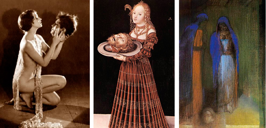
| 4 Mateo 14:8 |
Y ella, instruída primero de su madre, dijo: Dame aquí en un plato la cabeza de Juan el Bautista.
|
| 5 Mateo 14:11 |
Y fué traída su cabeza en un plato y dada á la muchacha; y ella la presentó á su madre.
|
| 6 Mateo 21:42 |
Díceles Jesús: ¿Nunca leísteis en las Escrituras: La piedra que desecharon los que edificaban, Esta fué hecha por cabeza de esquina: Por el Señor es hecho esto, Y es cosa maravillosa en nuestros ojos?
|
| 7 Mateo 26:7 |
Vino á él una mujer, teniendo un vaso de alabastro de unguento de gran precio, y lo derramó sobre la cabeza de él, estando sentado á la mesa.
|
| 8 Mateo 27:29 |
Y pusieron sobre su cabeza una corona tejida de espinas, y una caña en su mano derecha; é hincando la rodilla delante de él, le burlaban, diciendo: ¡Salve, Rey de los Judíos!
|
| 9 Mateo 27:30 |
Y escupiendo en él, tomaron la caña, y le herían en la cabeza.
|
| 10 Mateo 27:37 |
Y pusieron sobre su cabeza su causa escrita: ESTE ES JESUS EL REY DE LOS JUDIOS. |
|
|
|
|
|
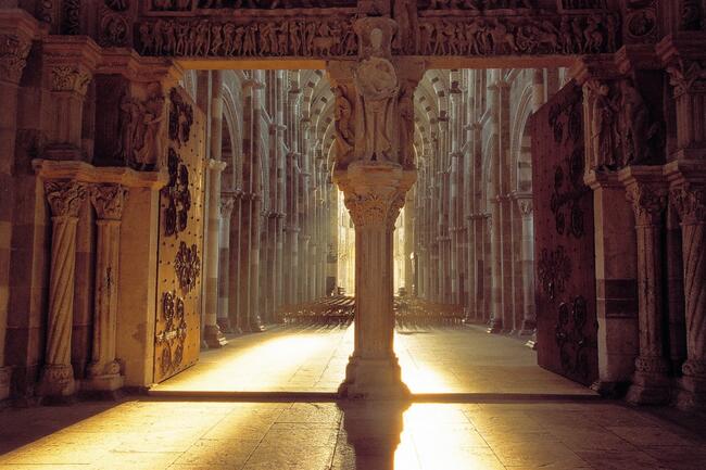
Astronomical alignment[edit]
Looking east through nave on 23 June 1976, two days after the summer solsticeMary Magdalene's relics in the crypt
In 1976, Hugues Delautre, one of the Franciscan fathers charged with stewardship of the Vézelay sanctuary, discovered that beyond the customary east-west orientation of the structure, the architecture of La Madeleine incorporates the relative positions of the Earth and the Sun into its design. Every June, just before the feast day of Saint John the Baptist, the astronomical dimensions of the church are revealed as the sun reaches its highest point of the year, at local noon on the summer solstice, when the sunlight coming through the southern clerestory windows casts a series of illuminated spots precisely along the longitudinal center of the nave floor.[13][14][15][16][17]
|
|
|
|
|
26 ene 2023 — Al mediodía del solsticio de verano en la basílica de Sainte-Madeleine en Vézelay se produce el curioso fenómeno del alineamiento de ...
Falta(n): JUNE | Realizar una búsqueda con lo siguiente: JUNE
Registered since June 24, 1994 in the Foundations Registry of the Ministry of Education, Culture and Sports. Santa María la Real Foundation. All rights ...
Both solstices are symbolized by John the Baptist (name day: June 24) and Jesus (Christmas: December 25). So, the basilica is one huge frame story and one ...
On June 24th, the birthday of John the Baptist, the sun is set in such a way that the light falls in places in the central aisle. This symbolizes stepping ...
|
|
|
|
|
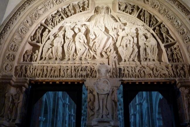
Tympanum of the Vézelay basilica
The Codex Calixtinus (12th century), the oldest 'travel guide' for the Camino de Santiago, mentions Vézelay as one of the four great gathering places for pilgrims in France. You can hardly imagine that now. As you walk up the main street to the famous basilica it is often quiet, except in high season when busloads of tourists pay a lightning visit to the town.
The tympanum on the facade of the basilica is also not really special. It is a copy of the original, badly damaged during the French Revolution, which until recently stood almost carelessly against the side wall of the church.
Only when you enter the basilica can you experience for yourself why Vézelay is still a special, spiritual place for many. The Romanesque tympanum on the porch is unique. It represents the proclamation of faith after the death of Jesus on the cross and his resurrection. (The first witness was Mary Magdalene, after whom the basilica is named.) Jesus is beautifully portrayed in the center, blessing the apostles and commanding them to convert the nations. Below him is John the Baptist, with the Lamb of God.
Sometimes the large interior doors of the basilica are open. Then behind the half-dark porch the light of the priest's choir beckons.
Several days a year, shortly after the summer solstice (June 21), the porch and the choir are even connected by a path of light that then falls through the precisely placed upper windows.
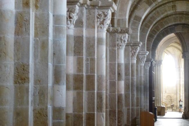
Six months later, shortly after the winter solstice (December 21), the capitals are highlighted equally.
Both solstices are symbolized by John the Baptist (name day: June 24) and Jesus (Christmas: December 25).
So, the basilica is one huge frame story and one big invitation to 'go up to the light'. For many, this makes it a real milestone on their pilgrimage.
The basilica and the hill of Vézelay have been on the Unesco World Heritage list since 1979.
The Maison du Visiteur (EN), halfway up Vézelay's main street, tells the fascinating story of the basilica through a film and scale models.
Before you leave, in the morning, you can receive a pilgrims' blessing. This takes place after the lauds, the mainly sung service -in the basilica or a chapel next to it- by the brothers and sisters of the Fraternités de Jérusalem (FR).
Register for this at the volunteer of the pilgrims' hostel in the Centre Sainte-Madeleine (diagonally opposite the basilica).
Agenda Vézelay
More information about Vézelay
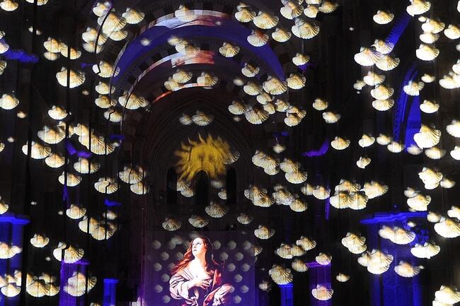
During a performance in the basilica.
|
|
|
|
|
Jordan River (Utah)
From Wikipedia, the free encyclopedia
The Jordan River, in the state of Utah, United States, is a river about 51 miles (82 km) long. Regulated by pumps at its headwaters at Utah Lake, it flows northward through the Salt Lake Valley and empties into the Great Salt Lake. Four of Utah's six largest cities border the river: Salt Lake City, West Valley City, West Jordan, and Sandy. More than a million people live in the Jordan Subbasin, part of the Jordan River watershed that lies within Salt Lake and Utah counties. During the Pleistocene, the area was part of Lake Bonneville.
Members of the Desert Archaic Culture were the earliest known inhabitants of the region; an archaeological site found along the river dates back 3,000 years. Mormon pioneers led by Brigham Young were the first European American settlers, arriving in July 1847 and establishing farms and settlements along the river and its tributaries. The growing population, needing water for drinking, irrigation, and industrial use in an arid climate, dug ditches and canals, built dams, and installed pumps to create a highly regulated river.
Although the Jordan was originally a cold-water fishery with 13 native species, including Bonneville cutthroat trout, it has become a warm-water fishery where the common carp is most abundant. It was heavily polluted for many years by raw sewage, agricultural runoff, and mining wastes. In the 1960s, sewage treatment removed many pollutants. In the 21st century, pollution is further limited by the Clean Water Act, and, in some cases, the Superfund program. Once the home of bighorn sheep and beaver, the contemporary river is frequented by raccoons, red foxes, and domestic pets. It is an important avian resource, as are the Great Salt Lake and Utah Lake, visited by more than 200 bird species.
Big Cottonwood, Little Cottonwood, Red Butte, Mill, Parley's, and City creeks, as well as smaller streams like Willow Creek at Draper, Utah, flow through the sub-basin. The Jordan River Parkway along the river includes natural areas, botanical gardens, golf courses, and a 40-mile (64 km) bicycle and pedestrian trail, completed in 2017.[6]
The Jordan River is Utah Lake's only outflow. It originates at the northern end of the lake between the cities of Lehi and Saratoga Springs. It then meanders north through the north end of Utah Valley for approximately 8 miles (13 km) until it passes through a gorge in the Traverse Mountains, known as the Jordan Narrows. The Utah National Guard base at Camp Williams lies on the western side of the river through much of the Jordan Narrows.[7][8] The Turner Dam, located 41.8 miles (67.3 km) from the river's mouth (or at river mile 41.8) and within the boundaries of the Jordan Narrows, is the first of two dams of the Jordan River. Turner Dam diverts the water to the right or easterly into the East Jordan Canal and to the left or westerly toward the Utah and Salt Lake Canal. Two pumping stations situated next to Turner Dam divert water to the west into the Provo Reservoir Canal, Utah Lake Distribution Canal, and Jacob-Welby Canal. The Provo Reservoir Canal runs north through Salt Lake County, Jacob-Welby runs south through Utah County. The Utah Lake Distribution Canal runs both north and south, eventually leading back into Utah Lake.[9] Outside the narrows, the river reaches the second dam, known as Joint Dam, which is 39.9 miles (64.2 km) from the river's mouth. Joint Dam diverts water to the east for the Jordan and Salt Lake City Canal and to the west for the South Jordan Canal.[10][11][12]
Map of the Salt Lake Valley
The river then flows through the middle of the Salt Lake Valley, initially moving through the city of Bluffdale and then forming the border between the cities of Riverton and Draper.[7] The river then enters the city of South Jordan where it merges with Midas Creek from the west. Upon leaving South Jordan, the river forms the border between the cities of West Jordan on the west and Sandy and Midvale on the east. From the west, Bingham Creek enters West Jordan. Dry Creek, an eastern tributary, combines with the main river in Sandy. The river then forms the border between the cities of Taylorsville and West Valley City on the west and Murray and South Salt Lake on the east. The river flows underneath Interstate 215 in Murray. Little and Big Cottonwood Creeks enter from the east in Murray, 21.7 miles (34.9 km) and 20.6 miles (33.2 km) from the mouth respectively. Mill Creek enters on the east in South Salt Lake, 17.3 miles (27.8 km) from the mouth. The river runs through the middle of Salt Lake City, where the river travels underneath Interstate 80 a mile west of downtown Salt Lake City and again underneath Interstate 215 in the northern portion of Salt Lake City. Interstate 15 parallels the river's eastern flank throughout Salt Lake County. At 16 miles (26 km) from the mouth, the river enters the Surplus Canal channel. The Jordan River physically diverts from the Surplus Canal through four gates and heads north with the Surplus Canal heading northwest. Parley's, Emigration, and Red Butte Creeks converge from the east through an underground pipe, 14.2 miles (22.9 km) from the mouth.[7] City Creek also enters via an underground pipe, 11.5 miles (18.5 km) from the river's mouth. The length of the river and the elevation of its mouth varies year to year depending on the fluctuations of the Great Salt Lake caused by weather conditions. The lake has an average elevation of 4,200 feet (1,300 m) which can deviate by 10 feet (3.0 m).[3] The Jordan River then continues for 9 to 12 miles (14 to 19 km) with Salt Lake County on the west and North Salt Lake and Davis County on the east until it empties into the Great Salt Lake.[7][8][11]
Discharge[edit]
The United States Geological Survey maintains a stream gauge in Salt Lake City that shows annual runoff from the period 1980–2003 is just over 150,000 acre-feet (190,000,000 m3) per year or 100 percent of the total 800,000 acre-feet (990,000,000 m3) of water entering the Jordan River from all sources. The Surplus Canal carries almost 60 percent of the water into the Great Salt Lake, with various irrigation canals responsible for the rest. The amount of water entering the Jordan River from Utah Lake is just over 400,000 acre-feet (490,000,000 m3) per year. Inflow from the 11 largest streams feeding the Jordan River, sewage treatment plants, and groundwater each account for approximately 15 percent of water entering the river.[13]
Watershed[edit]
Map of the entire Jordan River Basin
|
|
|
 Primer
Anterior
33 a 47 de 47
Siguiente Primer
Anterior
33 a 47 de 47
Siguiente
 Último
|
|
| |
|
|
©2024 - Gabitos - Todos los derechos reservados | |
|
|